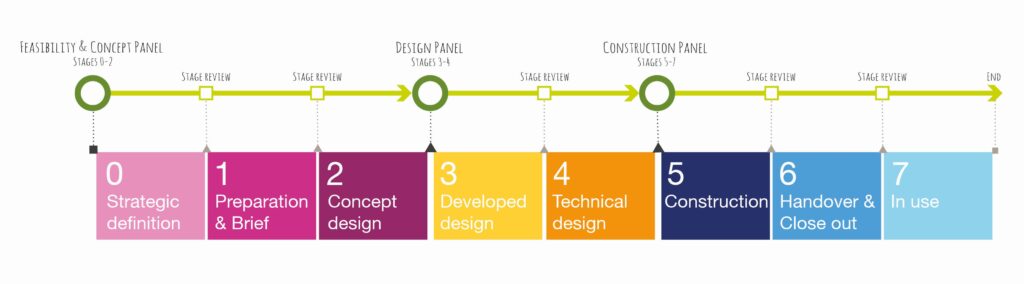
Final submissions for Places for Everyone Concept (Stages 0-2) applications are due by the end of August 23rd 2022.
Ahead of this, an information session was delivered to community-led organisations, which had received a successful Expression of Interest outcome. A small cohort of the Places for Everyone team provided an overview of the Application Guidance and supplementary guidance for community-led organisations and outlined the next steps in the process.
Key questions answered
Are letters from stakeholders (for example, support letters) required? They aren’t required; however, they will support your application as evidence.
How detailed should the estimated costs be, and do you have advice on what approach to take when calculating these figures? We don’t expect accurate figures, so provide your best guess at this stage.
Is there guidance on existing project costs to refer to? Sustrans have not created guidance for this because it can vary significantly. It is a good idea to use the resources you have, and you can search online for comparable projects. The important part is evidencing why you have come to that conclusion. Transport Scotland has some guidance on their website on to arrive at estimation costs.
Do you have a list of consultants and contacts that have been involved in similar work? We are unable to provide a list of consultants or to provide recommendations taking in to account it is public funding.
Is it possible to arrange an appointment with a Grant Advisor before submitting the full application? We can arrange individual appointments for those who would find this beneficial and have received a successful Expression of Interest outcome. To arrange this, please email PlacesForEveryone@sustrans.org.uk with suggestions of dates/times that are convenient for you.
Is it okay to have an overlap in the delivery team e.g., Community Engagement Lead and Communications Lead to be the same person?An overlap in the delivery team is acceptable.
Is an email sufficient evidence of support from local authorities? Yes, if it is clear and it has a signature with their name, job title and organisation.
Full slides from the session can be downloaded below:
Final submissions for Places for Everyone Concept (Stages 0-2) applications are due by the end of August 23rd 2022.
Ahead of this, Heads of Programme Chiquita Elvin and Simon Strain outline the key changes to the Places for Everyone application process and answer a number of questions from applicants.
Key questions answered
How essential is it for local authorities to submit Expressions of Interest for new projects? Expressions of Interest allow applicants to receive a quick response on whether their project proposal aligns with the aim of Places for Everyone, thereby reducing the time expended on a full application for a project proposal that is not eligible.
If a project is being delivered as a trial within a calendar year, what stage should this be submitted to: 0-2, 3-4, 5-7? We consider trials from stages 0 to 4, therefore it would be 100% funded. If you’re needing to run trials to decide on a preferred option, then we’re happy to discuss this with you to determine which stage the trial would be most appropriate.
Will Sustrans consider retrospectively funding projects? For consistency and transparency, we’ll be looking to only be funding work into the future or yet to happen.
If your Expression of Interest is unsuccessful, can you make amendments to your proposal and still apply through the portal? Yes, Places for Everyone can provide feedback on why the project was considered ineligible. Changes can then be made in response to this feedback and a second expression of interest submitted to reassess eligibility.
Is the fund open to local authorities only or can community councils/groups apply if they have a proposal? The fund is open to applications from community organisations including community councils, development trusts and more. We wouldencourage interested parties to read the guidance for community organisations.
If we have undertaken Concept (Stages 0-2) with another agency, should we still submit our expression of interest? Yes, the expression of interest assesses the project’s eligibility for funding. Please refer to the deliverables for stages 0-2 to assess if all deliverables have been sufficiently met by the previous agency.
Have you increased your standards (i.e. paths should be a minimum of 3 metres in width)? Working to the standards specified in Cycling By Design, the width of paths in our projects should be appropriate for the estimated levels of usage. The benefits of a wider path enable improved comfort, travelling side-by-side, social experiences, and more robust infrastructure. However, we recognise there are barriers to development, such as width constraints, geological constraints, and land ownership. We promote a width of at least 3 metres wherever possible.
Is there support available to go over draft applications ahead of submission? This service is not currently available, though we wish to organise this in future – recruitment is ongoing. Currently, we can offer technical support for all applicants, and additional application support for community groups.
Due to heritage constraints, it’s not easy to build cycle infrastructure (e.g. cycle lanes on setted streets). Will this type of project be scored lower or will this be something that is taken into consideration? Scoring for this type of project would not be affected. We would encourage consideration of alternate routes that utilise streets that are un-setted, safer or more suitable.
Is there any additional support for community groups with the application? We have organised three Applicant Information Sessions for community organisations during week commencing Monday 15th August 2022, which are available to community organisations who have submitted an expression of interest and were successful at this stage.
Full slides from the session can be downloaded below:
Following the Covid-19 pandemic, the Places for Everyone fund is open to Concept (Stages 0-2) project applications.
Funded by the Scottish Government, Places for Everyone aims to create safer, more attractive, healthier, and inclusive places by increasing and diversifying the number of trips made by walking, wheeling, or cycling for everyday journeys.
Concept (Stages 0-2) projects are the first step in delivering high quality active travel infrastructure, serving to define the scope of a project, its desired outcomes and helping to develop a final project concept design.
What does this mean for you?
Both new and existing partners, big and small, are invited to apply for funding, from large statutory organisations like local authorities to smaller community organisations and development trusts.
We can award 100% of design costs and 70% of construction costs and will work with you to identify any match funding needed.
All our Places for Everyone partners can also look forward to receiving tailored support and guidance from Sustrans to ensure every project achieves the best possible outcome.
“Delivering high quality and accessible walking, wheeling, and cycling infrastructure has always been of the utmost importance to us. From multi-million-pound city transformations to new rural community active travel links, the Places for Everyone fund has allowed us to work closely with partners all across Scotland. We look forward to continuing to support more active travel projects to becoming a reality”.
“Sustained investment in walking, wheeling, and cycling infrastructure is crucial in helping to build a more active nation. With the Places for Everyone fund now open to new applications, supported by record funding here in Scotland for active travel, we will continue to enable our villages, towns and cities to build the right kind of transformative infrastructure in the right places – making active travel easier for shorter everyday journeys.”
Patrick Harvie, Minister for Active Travel, Scottish Government
What are the key dates?
All of our key upcoming dates, including those for other upcoming stage groupings, can be found below:
After more than a year away, the Places for Everyone fund is set to open again to new and existing project applications for Concept (Stages 0-2) from 25th July 2022.
To prepare for this, our team are working hard to ensure that updated Application Guidance is made available to partners as soon as possible.
This updated guidance will be made available to all partners on 11th July 2022.
From the opening date of 25th July 2022, partners will then have four weeks to submit their applications for the deadline of 23rd August 2022.
A Decision Making Panel will be held on 31st October 2022.
Updated programme aim
We have brought our programme aim up to date to emphasise that projects which receive Places for Everyone funding should be truly for everyone.
All Places for Everyone projects must deliver capital infrastructure which helps to achieve this aim to:
Create safer, more attractive, healthier, and inclusive places which are enjoyed equitably by increasing and diversifying the number of trips made by walking, wheeling or cycling for everyday journeys.
Examples of the types of projects Places for Everyone is able to fund can be found on the Our Projects page.
New Expression of Interest
We will be launching an online Expression of Interest form via our partner-facing Places for Everyone page on 11th July 2022.
A new shorter Expression of Interest form will allow partners to submit a basic project proposal to Places for Everyone and receive a response within one week as to whether the proposed project is something Places for Everyone can fund.
Whilst submitting an Expression of Interest is not mandatory, it is strongly recommended and will help us to process your Full Application more quickly.
The only information required from an Expression of Interest proposal will be the contact details of your organisation and a basic description of the project proposed, including it’s aims and which Stage(s) funding is being applied for.
If your Expression of Interest is successful, you will be invited to submit a Full Application via the Project Portal.
There are three separate project applications groupings which can be applied for through Places for Everyone. Concept (Stages 0-2); Design (Stages 3-4); and Construction (5-7).
Clearer eligibility for community organisations
To support community organisations to understand whether they are eligible we will be launching a quick and anonymous Eligibility Assessment on Monday 11th July 2022.
This Eligibility Assessment will ask community groups to complete a short set of ‘Yes’ or ‘No’ questions and receive an immediate response on whether they are eligible to apply for funding.
Eligible community organisations will then be invited to submit an Expression of Interest form, provided they already have a project vision in mind.
The Eligibility Assessment will consider the following requirements:
Ability to manage long-term financial obligations
Possession of Public Liability Insurance
Support from relevant local authority
Understanding of CDM regulations
Possession of a signed constitution
Required number of board members in accordance with constitution
Key dates
Applications, Deadlines and Panels
Applications for new and existing Concept (Stage 0-2) projects open on July 25th 2022.
Updated guidance will be made available on 11th July 2022.
The application deadline for Concept (Stage 0-2) projects is 23rd August 2022.
A Decision Making Panel will be held on 31st October 2022.
Expressions of Interest
An online version of our Expression of Interest form will launch for all partners on 11th July 2022.
Eligibility
An Eligibility Assessment for community organisations will launch on 11th July 2022.
Please don’t hesitate to get in touch with us if you have any questions.
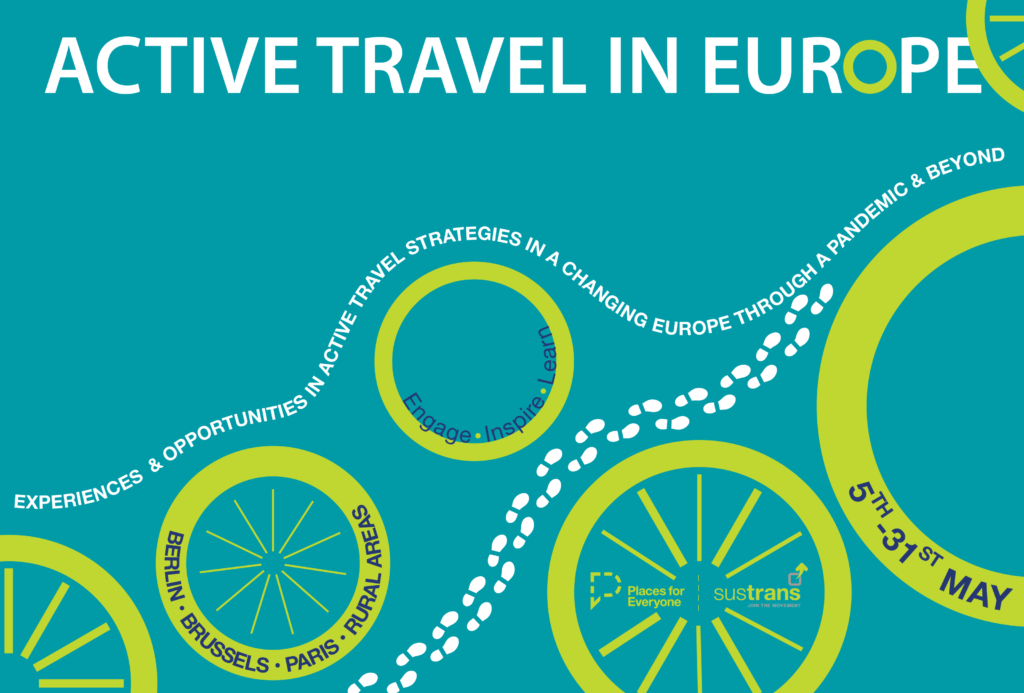
The event poster for the Active Travel in Europe webinar series
Introduction
We hear from a fantastic line up of speakers who present and share experiences of the increase of temporary active travel interventions and strategies during the pandemic in Europe, and how these can shape the way for future long-term measures and solutions. By coming together and learning from each other, it may be possible to keep this momentum going – to transform temporary solutions into more permanent implementations and accelerate the development of sustainable active travel infrastructure across Europe.
The event poster for the Active Travel in Europe webinar series
Paris
Clotilde Imbert, Director of Copenhagenize France, presents case studies from Paris, a city that has seen an increase in temporary cycle paths but also a high increase in cycling since the beginning of the pandemic. In addition, the mayor of Paris, Anne Hidalgo, has an ambitious strategy, ‘Plan Vélo’ to transform Paris into a cycle-friendly city.
According to European Cyclists’ Federation, since the pandemic, France has added €300m in funding for the country’s cycling infrastructure. In the opinion column, ‘A unique opportunity to speed up the implementation of bicycle plans‘ on Copenhagenize’s website, Clotilde expands on her view of the possibilities and strategies that she believes should take place as a next step in creating permanent active travel infrastructure in France.
Brussels
Florine Cuignet, Policy Officer of GRACQ, shares how GRACQ represents cyclists and promotes cycling in the french-speaking parts of Belgium. According to European Cyclists’ Federation, Brussels is one of the cities that implemented the most cycle lanes during the pandemic in Europe. In addition, the country added almost €480m in their cycling infrastructure budget in response to the pandemic.
Last year the Belgian federal government, for the first time, published a cycling action plan for the country. The plan consists of 52 action points that will facilitate and promote cycling, which will be implemented by 2024.
Ed Lancaster, Director of EuroVelo at the independent non-profit association European Cyclists’ Federation, presents case studies from rural areas in Europe. EuroVelo (European cycle route network) is a cooperation between different national and regional partners. The aim is to ensure that there are very high quality European-grade cycle routes and networks across Europe.
In January, EuroVelo presented the news that cycling on the EuroVelo routes have continued rising since the pandemic. In addition, ECF is also partner for the cross-border BIGIMUGI project that ‘aims at developing cycling mobility for all in rural areas situated along EuroVelo 3’.
Ragnhild Sørensen shares more about work that the Berlin-based organisation, Changing Cities, do. As many other cities, Berlin has created pop-up cycle lanes during the pandemic, something that has not been appreciated by all political parties. The pop-up cycle lanes were monitored and developed according to feedback. The organisation has also launched the campaign Kiezblocks in Berlin, where more than 50 local initiatives want to limit the permeability of the road network for motorised individual transport (MIT) while prioritising walking and cycling on non-arterial streets. Kiezblock is a strategy for transformational urban adaptation, initiated by locals.
Panel Session
In this panel session, we welcome back all keynote speakers to answer pre-submitted and unanswered questions. The panel session will also include discussion around key themes identified throughout the series, including:
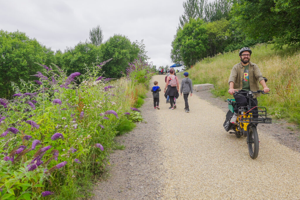
Individual cycling and group of friends walking along a new active travel path at Glasgow's Claypits
Partners from local authorities and organisations around Scotland were invited to hear from two guest speakers on how to make the case for active travel.
During the event, delegates were also given the opportunity to join smaller groups to share their own experiences, knowledge and relevant resources.
Setting the scene
Dr David Caesar, Senior Strategic Advisor of Scottish Government shares the benefits of active travel, including how active travel improves public health and tackles health inequalities.
Making the case to residents and the local population
From messaging and communication to focusing on the positives, Dr Paul Kelly, Director of Paths for All and Lecturer in Physical Activity for Health at the University of Edinburgh, advises on how to make the case for active travel to local residents.
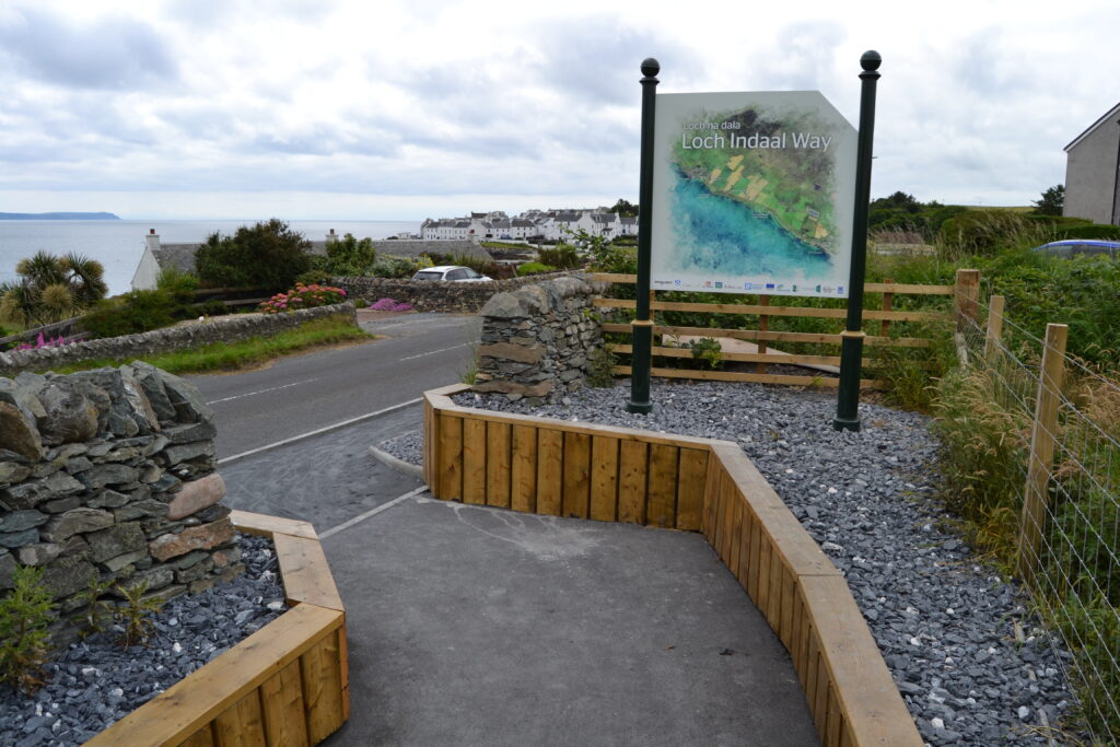
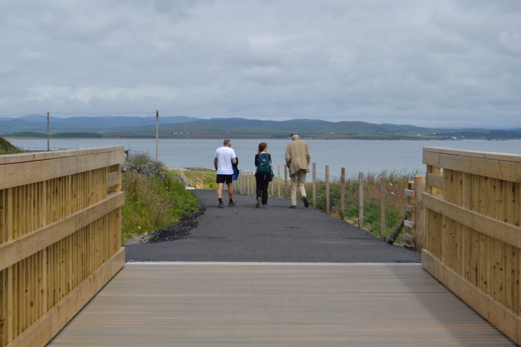
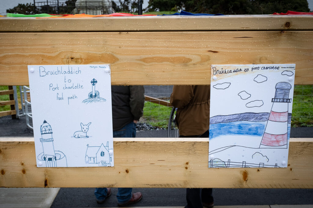
The Loch Indaal Way joins the communities of Port Charlotte and Bruichladdich via a safe, accessible and traffic-free route.
Prior to this, the sole existing link between the two communities was a section of the A847 carriageway, a national speed limit road which offers little protection to those walking wheeling and cycling on the island.
The newly completed off-road route has already proved popular with local residents and business owners, with its frequency of use expected to greatly increase when the tourist season returns.
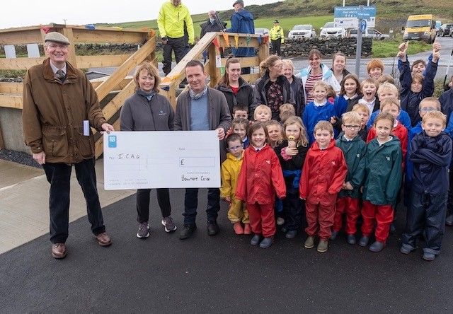
The Loch Indaal Way project was spearheaded by the Islay Community Access Group (ICAG), a local network of volunteers with a vision to increase health and wellbeing through greater outdoor accessibility.
Patrick McGrann, Head of the ICAG, said:
“ICAG, a small voluntary group, worked for 6 years to deliver the Loch Indaal Way. We are extremely proud of our new community asset .To see local folk and visitors of all ages and abilities enjoying access to the countryside is heart warming. We have involved our community throughout and all have ownership and satisfaction of a job well done.”
Pat McGrann, Head, Islay Community Access Group
With the support of Sustrans’ Places for Everyone programme, ICAG secured the a large part of the funding to deliver the 2.53km off-road active travel route.
Sustrans and ICAG previously worked together to deliver the lauded Three Distilleries Path at Port Ellen, a popular 5km active travel route which takes in the Laphroaig, Lagavulin and Ardbeg distilleries.
Emily Gait, Infrastructure Coordinator for Sustrans, said:
“The Loch Indaal Way is a great example of where a community have worked together to create a project which meets the needs of the people who live and visit the area. Inclusive designs and strong community backing have been key to the ultimate success of this project.
Going forward, we hope this inspires other small communities across Scotland to nurture their own walking, wheeling and cycling ambitions.”
Emily Gait, Infrastructure Coordinator, Sustrans
Key features of the route include three upgraded and newly created crossings, as well as landscaping and placemaking initiatives such as the provision of comfortable seating areas and shrubbery sections.
Smooth gradients and minimal placement of steps also maximise accessibility for users with limited mobility.
The proposals to create a new off-road walking, wheeling and cycling route between Port Charlotte and Bruichladdich received popular community support from the outset.
Through an proactive and considered period of engagement, ICAG worked closely with local landowners to secure necessary land donations to make the path a reality.
The local Bruichladdich Distillery also became involved in the promotion and funding behind the project, even entering into a maintenance agreement with ICAG to ensure to path stays fit for purpose.
AJ Cunningham, Operations Manager at Bruichladdich Distillery, said:
“Even before the path was finalised, it was being adopted by a lot of locals. I don’t think this was out of them being inquisitive, either. It’s just a really enjoyable and risk-free way to walk where they didn’t have that option before.
I don’t think it could’ve worked out any better unless you took it all the way out to Bridgend!”.
AJ Cunningham, Operations Manager, Bruichladdich Distillery
Evident local enthusiasm for project only further increased as construction got well underway against the backdrop of the coronavirus pandemic.
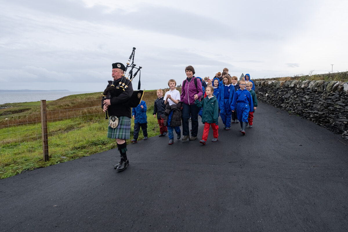
At an opening event in October of last year, children from Port Charlotte Primary School led a procession along the Loch Indaal Way from the Port Ban war memorial to Bruichladdich Town Hall.
They were joined on-route by local residents, members of ICAG and the local Baptist Minister, as well as the musical stylings of the Islay Pipe Band.
After passing several renowned destinations, including the Bruichladdich Distillery, the event culminated in a ceremonial ribbon cutting, which officially opened the route for all users to enjoy.
A recently installed cycle repair station has also been well received by the community, ensuring daily errands, active commutes and leisure trips are able to continue with minimal disruption.
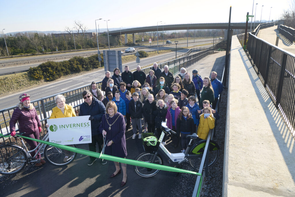
Extending from Raigmore Interchange to the Golden Bridge, a new walking, wheeling and cycling link funded by Places for Everyone has been officially opened in Inverness.
The Raigmore Active Travel Link, will enable a safe, traffic-free option for those wishing to access Raigmore Estate, Inverness Campus, Inverness Shopping Park.
The accessible route also smartly joins up with other active travel infrastructure in the area to provide connections with Raigmore Hospital, local employers and onwards to retail and residential areas.
As the first Places for Everyone project to be awarded Category 4 status in the Highlands, this marks a significant moment for the programme.
The wide route delivers a smooth and graded surface for users to make access to key destinations as convenient as possible.
The Raigmore Active Travel Link has been designed to provide a low gradient route, reducing the effects of the steep hill leading up to the Raigmore Community, providing a wide walking, wheeling and cycling ramp with rest areas for all users to enjoy.
The existing stairs which joined Raigmore Community to the interchange have been upgraded to tie into the new design, to ensure quick direct access.
The next phases of this project involve working with Transport Scotland and Sustrans at Raigmore Interchange.
Additionally, work is beginning to look at the potential for active and bus infrastructure linking the Interchange to the city centre along Millburn Road, utilising active travel and Bus Partnership Funding.
Consultation and engagement on these future phases will take place during 2022.
Opening the Link
The site was officially opened by Elected Members, Raigmore Community Council, and the Primary 5 pupils from Raigmore Primary School nearby, who are Junior Road Safety Officers (JRSOs) for the school .
These JSROs are an important part of the primary school as they help raise road safety awareness and promote road safety issues to everyone in the school and the wider community, and the pupils have been very eager to learn about the new infrastructure which has been created in their local area.
Pupils from Raigmore Primary School joined Council staff last week to learn about the new link. Video: The Highland Council.
The pupils joined Council staff on site last week to learn about the active travel infrastructure and to be part of some filming on the active travel link.
Bet McAllister, Depute Provost of Inverness said:
“This is the first large active travel investment in Inverness which Highland Council have delivered in partnership with our project partners and funders Sustrans, through their Places for Everyone fund. To have a significant, high quality investment enabling safe, direct routes for walking, wheeling and cycling will help to encourage local people to be more active for everyday journeys, while also reducing our impact on climate change. We celebrate the opening of this link today, but we are looking forward to the significant future investment which is planned as part of the Active Travel Network over the coming years.”
Bet McAllister, Depute Provost of Inverness
The Raigmore Active Travel Link has been funded through Sustrans’ Places for Everyone programme as part of the Inverness City Active Travel Network, a £10.6m active travel project investing in key walking, wheeling and cycling routes throughout the city.
Maelle Ducreux, Infrastructure Coordinator for Sustrans, said:
“The new Raigmore Active Travel Link will have an immediate positive impact on people walking, wheeling, and cycling between the Campus, Raigmore Estate and Inverness City Centre. These benefits will be felt further when improvements planned for Raigmore Interchange and Millburn Corridor are implemented. The development has also provided the opportunity to reinstate native tree species along the embankment which not only make the route more attractive but will provide valuable shielding from the trunk road”.
Maelle Ducreux, Sustrans
The Active Travel Link took 40 weeks to complete, and was constructed by Pat Munro, a local contractor who won the tender for this work. Mark Smith, Contracts Manager at Pat Munro, said:
“The Raigmore Active Travel Link has been a great project to be involved in and we’re delighted it is now open to the public.
The Raigmore community has been very understanding throughout the construction so we’d like to thank them, once again, for their patience. We hope the local community and others travelling by foot, bike or wheel enjoy using the travel link for many years to come.”
Mark Smith, Pat Munro
Munro Ross, Chair of Raigmore Community Council, said:
“This has been an exemplar project in terms of community engagement and professional work taking place in our community. We look forward to engaging with future projects in the local area, the bar has now been set in terms of engagement and expectations.”
Photography by Whyler Photos of Stirling
www.whylerphotos.com - 01786 474340
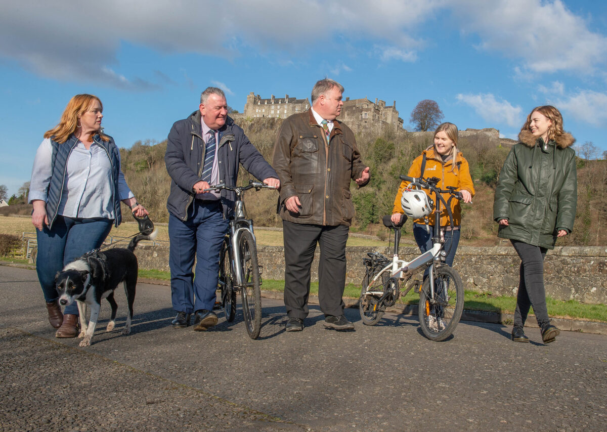
From left to right: Clackmannshire Council Leader Cllr Ellen Forson with dog Loki, Stirling Council Leader Cllr Scott Farmer, Stirling Council Depute Leader Cllr Chris Kane, Sustrans Portfolio Director for Scotland Karen McGregor, Environment Advisor at the University of Stirling Amy Gove-Kaney. Photo: Stirling Council/Whyler Photos.
A landmark project for the city, the scheme intends to not only improve safety and accessibility for those travelling by foot and wheel, but also seeks to increase economic activity and footfall for local businesses.
The project received £6.8m in funding from Places for Everyone, as well as £2.5m of Scottish Government investment from the City Region Deal and £258k from Stirling Council’s developer contributions allocation.
The city-wide plan also presents Stirling Council and partners with new place-making and tourism opportunities along the new routes, with the infrastructure also laying the foundations for future connections to Clackmannanshire and the wider Forth Valley region.
A detailed look
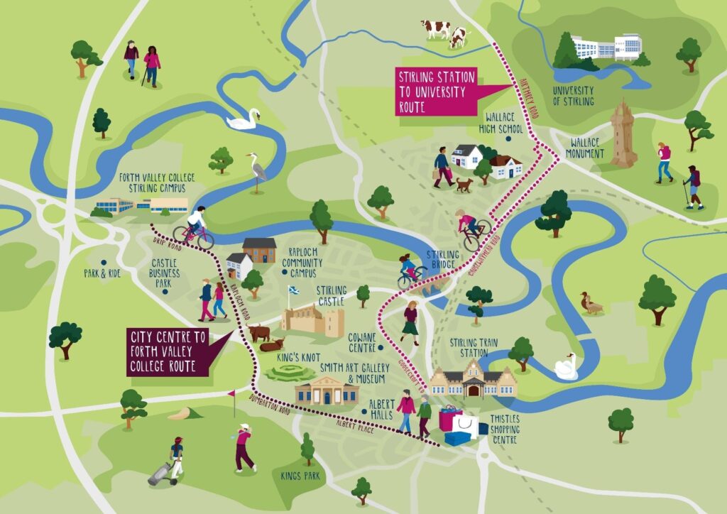
The project will deliver two main connections throughout the wider city. Illustration: Stirling Council
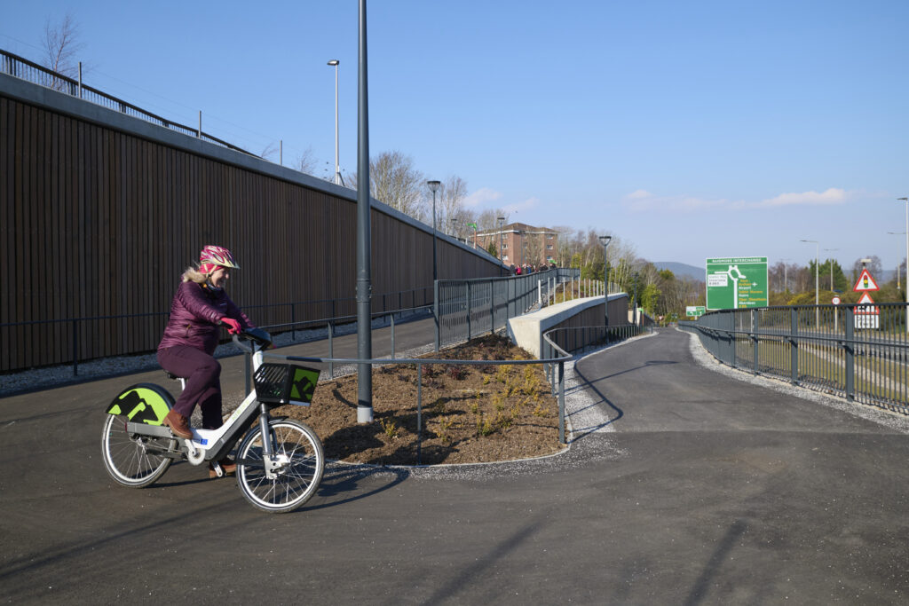
6.5km of new infrastructure will be created in total, smoothly interlinking with existing but currently disconnected routes across the city in order to connect communities, businesses and higher education institutes throughout Stirling for active travel for the first time.
Route one will provide a safe and accessible route between Stirling Train station and the University of Stirling, taking in iconic landmarks like Old Stirling Bridge and the National Wallace Monument along the way.
Route two will bridge the gaps between Forth Valley College and the City Centre along Albert Place, Dumbarton Road and Raploch Road, under the shadow of Stirling Castle.
The wider picture
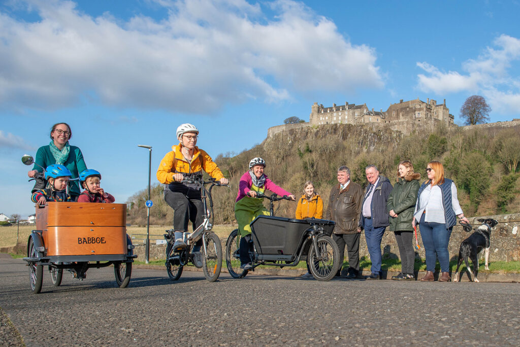
The two new routes will pass iconic sites such as Stirling Castle and Wallace Monument. Photo: Stirling Council/Whyler Photos.
In attendance at a launch event for the project alongside local councillors, residents and business owners, Sustrans’ Portfolio Director Karen McGregor said:
“Walk, Cycle, Live Stirling is a truly transformative project that we at Sustrans are excited to be working on as part of our Places for Everyone programme. The project will make walking, wheeling and cycling safer and more enjoyable for everyone, making it easier for people to move between the iconic landmarks that make Stirling the unique place that it is.”
Karen McGregor, Sustrans
Stirling Council Leader, Cllr Farmer said:
“For the first time ever we’ll be able to create seamless sustainable travel options that link the institutions and businesses of our City with their local communities, setting a new standard of local active travel infrastructure.
This investment will make it easier to walk or wheel around Stirling and we hope this improved and increased access will not only meet the growing demands for better active travel infrastructure, but embed a culture that embraces cycling, walking and wheeling in the everyday lives of the people who live, work and visit Stirling.”
Cllr Farmer, Stirling Council Leader
As one of the cornerstone projects of the £90.2million Stirling and Clackmannanshire City Region Deal, Walk, Cycle, Live Stirling delivers connections which extend far beyond the city itself, whilst also further emboldening the Scottish Government’s plan to tackle climate change.
Clackmannanshire Council Leader, Ellen Forson said:
“I am delighted to see this project start to take shape. It will improve connectivity for our residents by providing a link to routes already established in Clackmannanshire, and is a great example of partnership working through the Stirling & Clackmannanshire City Region Deal.”
Cllr Forson, Clackmannanshire Council Leader
Scottish Government Economy Secretary Kate Forbes said:
“These walking and wheeling corridors will promote more sustainable travel, healthier lifestyles and opportunities for tourism while connecting Stirling’s educational institutions, businesses and communities.
This is helping deliver the bold and ambitious actions we need to help reduce carbon emissions to net zero and encourage sustainable economic growth.”
Kate Forbes, Scottish Government Economy Secretary
Initial construction will start in tandem on Raploch Road East near the King’s Knot, and Airthrey Road near the University.
The project is due to be completed by March 2024, whereupon Walk, Cycle, Live Stirling will serve as a major active travel network for communities across the wider Stirling landscape.
FREE TO USE / James Chapelard/Scottish Canals
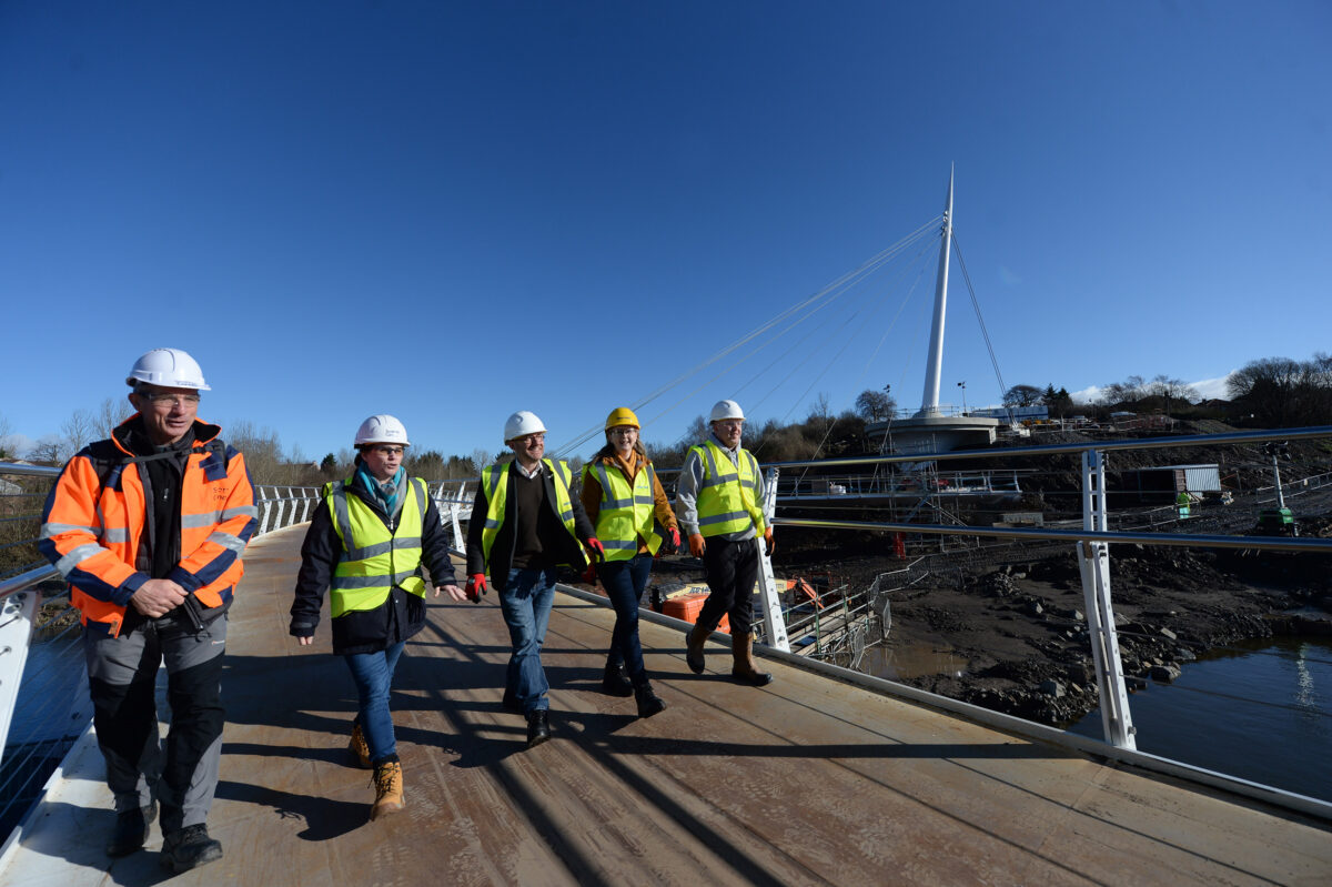
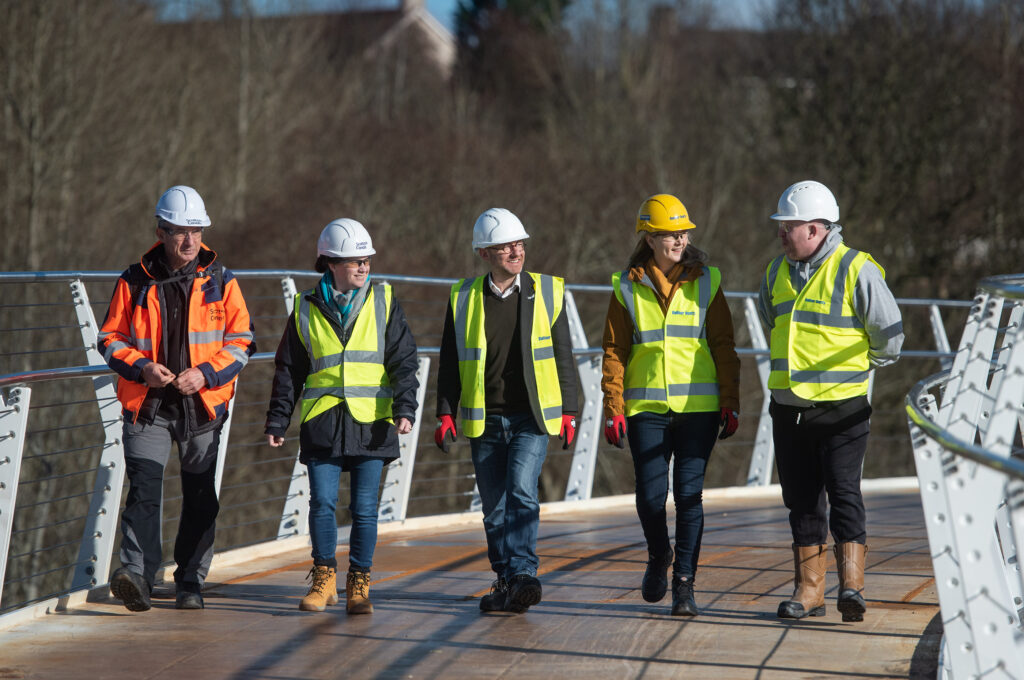
Minister for Zero Carbon Buildings, Active Travel and TenantsÕ Rights Patrick Harvie, crosses the new £13.7m Stockingfield active travel bridge, across the Forth & Clyde Canal Maryhill, Glasgow, Scotland, to celebrate the construction phase of the project. February 21, 2022. Left to right; Andrew Thin, Scottish Canals, Catherine Topley is the Chief Executive Officer at Scottish Canals, Patrick Harvie MSP, Karen McGregor, Sustrans, and local resident David Galbraith.
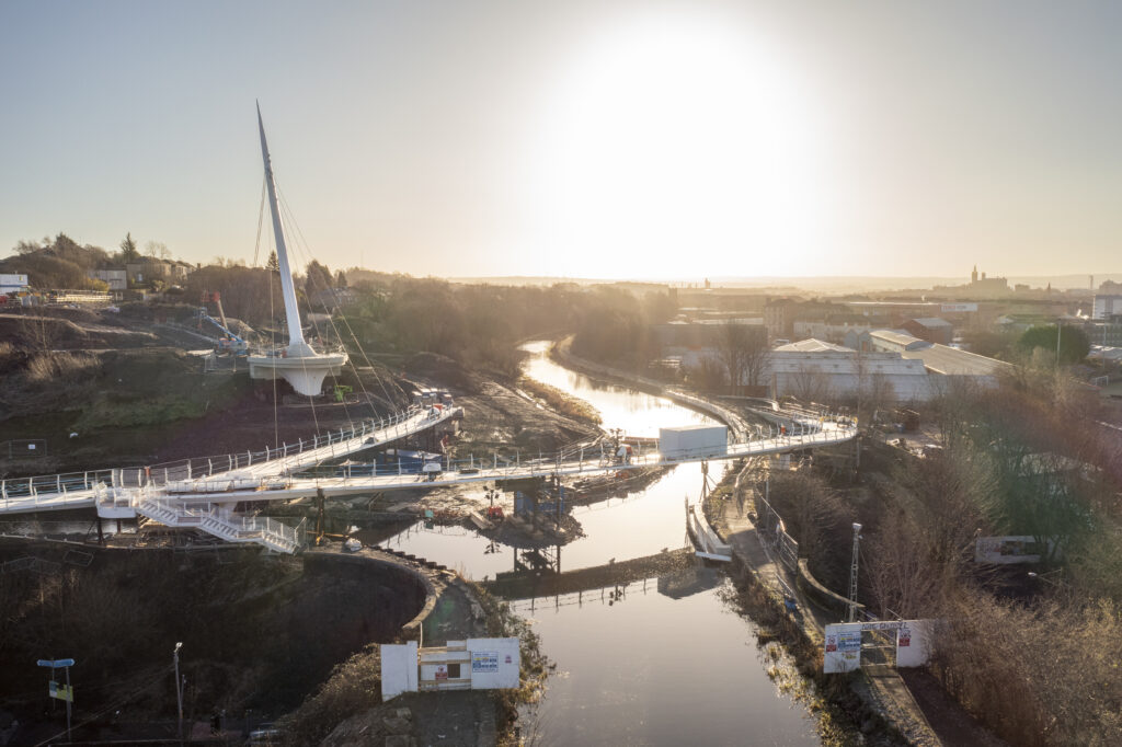
For the first time since the waterway's opening in 1790, Stockingfield Bridge will connect the communities of Maryhill, Gilshochill, and Ruchill in North Glasgow. The bridge, which is a significant piece of national infrastructure, also serves as the final link in the canal towpath,
offering a continuous active travel route along the whole length of the canal from Bowling on the Clyde to Edinburgh in the east via the Union Canal.
The construction phase of a new £13.7m landmark active travel bridge across the Forth & Clyde Canal has now concluded and is on track to open in September, completing
Scotland's National Walking and Cycling Network through the Lowland Canals.
To mark the occasion, Minister for Zero Carbon Buildings, Active Travel and Tenants'
Rights, Patrick Harvie MSP was the first to cross the Stockingfield Bridge and reconnect the communities.
Key project partners, including representatives from Scottish Canals, Sustrans, Glasgow City Council and Balfour Beatty were also in attendance for the first crossing.
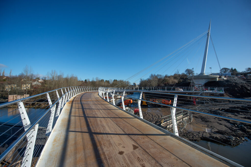
The first crossing of many. The new bridge provides a key walking, wheeling and cycling link across North Glasgow. Photo: James Chapelard/Scottish Canals
An iconic design and construction
The completed construction of Stockingfield Bridge marks a significant milestone for the £13.7 million Places for Everyone project.
Once complete, the bridge will connect the communities of Maryhill, Gilshochill, and Ruchill in North Glasgow for walking, wheeling and cycling for the first time.
A major boost to health and wellbeing, the new bridge will give local residents stunning views of the city and a convenient access point to the Forth & Clyde Canal in a way not before possible.
The stylish construction of Stockingfield Bridge. Photo: Scottish Canals.
The uniquely forked structure of the bridge not only maximises the number of active travel connections available to users, including improved accessibility to Glasgow west end and city centre, but also serves as a stylish centrepiece to the restored greenspace in the area.
Added public realm improvements, such as seating areas and tree and shrub planting, will help build a sense of community in the area and offer shared space for relaxation and socialisation.
The imminent addition of community artworks along the route will further consolidate the value of the impressive structure.
For those walking, wheeling or cycling further afield, the completion of the bridge also links together the smooth and continuous route stretching the length of the canal from Bowling on the Clyde to Edinburgh in the east via National Cycle Network Route 754.
The inaugural crossing
Left to right: Andrew Thin, Scottish Canals, Catherine Topley is the Chief Executive Officer at Scottish Canals, Patrick Harvie MSP, Karen McGregor, Sustrans, and local resident David Galbraith. Photo: James Chapelard/Scottish Canals
To mark the construction of Stockingfield Bridge, representatives from Scottish Canals, Glasgow City Council and Sustrans joined Minister for Zero Carbon Buildings, Active Travel and Tenants’ Rights, Patrick Harvie MSP as well as local residents to be the first to cross Stockingfield Bridge.
Minister for Active Travel Patrick Harvie said:
“It’s fantastic to see the Stockingfield Bridge take final shape and reconnect communities across the north of Glasgow. The Scottish Government has provided over £13 million to deliver this project because it unlocks real change in the opportunities that people will have to travel more actively – improving health, wellbeing and protecting our environment.
Patrick Harvie, MSP, Scottish Green Party
The project is being delivered by Scottish Canals with funding from the Scottish Government through Sustrans’ Places for Everyone scheme, as well as the Glasgow City Council’s Vacant Derelict Land Fund.
Karen McGregor, Portfolio Director for Sustrans, said:
“The completed construction of Stockingfield Bridge creates invaluable space for walking wheeling and cycling, and represents a significant improvement to the health and wellbeing of the people of North Glasgow.
“Not only does this new connection create a safe and convenient active travel route between Ruchill, Gilshochill, Maryhill and on to the west end and city centre, it opens up a scenic setting for residents and visitors in the area to relax and enjoy what the Forth and Clyde Canal has to offer.”
Karen McGregor, Sustrans
Richard Millar, Chief Operating Officer at Scottish Canals, said:
“Stockingfield Bridge will greatly boost active travel alternatives for people travelling about the city, making a walking or wheeling commute to work a viable and enjoyable experience.
For the first time, locals will be able to move effortlessly from these three communities to the city centre and the west end, providing new access to amenities, services, and employment possibilities. The project’s community-led art element will make Stockingfield a completely new destination, attracting new people to visit and raising the reputation of this section of the city to new heights.”
Richard Millar, Scottish Canals
Community artworks to come
Groundwork and community art installations will continue until September, which will mark the end of the project. Photo: James Chapelard/Scottish Canals
People travelling by foot and wheel will soon be able to enjoy everything the project has to offer.
Final works include groundwork initiatives along the towpath, which incorporates a new recreational space and the delivery of 8 community artwork installations, celebrating the proud industrial history of the area.
All of the artworks have a local link along with community participation. They range from sculptures commemorating the area’s industrial background to ceramic mosaics created by the community and metalwork honouring the role of disabled people in North Glasgow.
The project is due to be completed during the 200th anniversary of the Union and Caledonian canals in September, when the bridge will open to the wider public.
The conclusion of this landmark undertaking will mark a new era for Scotland’s inland waterways, one that prioritises active travel, health, and community.