Neil Hanna Photography
www.neilhannaphotography.co.uk
07702 246823
What do you need to know?
Following Transport Scotland’s announcement, Places for Everyone is pleased to be able to confirm a significant change in the match funding requirements for projects.
All projects are now eligible to receive up to 70% funding towards construction costs.
In addition, the 10% cap on pre-construction funding will now only be applied once projects reach construction, i.e. pre-construction funding will be extended 100% and any over payment will be deducted from the grant made available for construction (this will be subject to the Places for Everyone teams discretion).
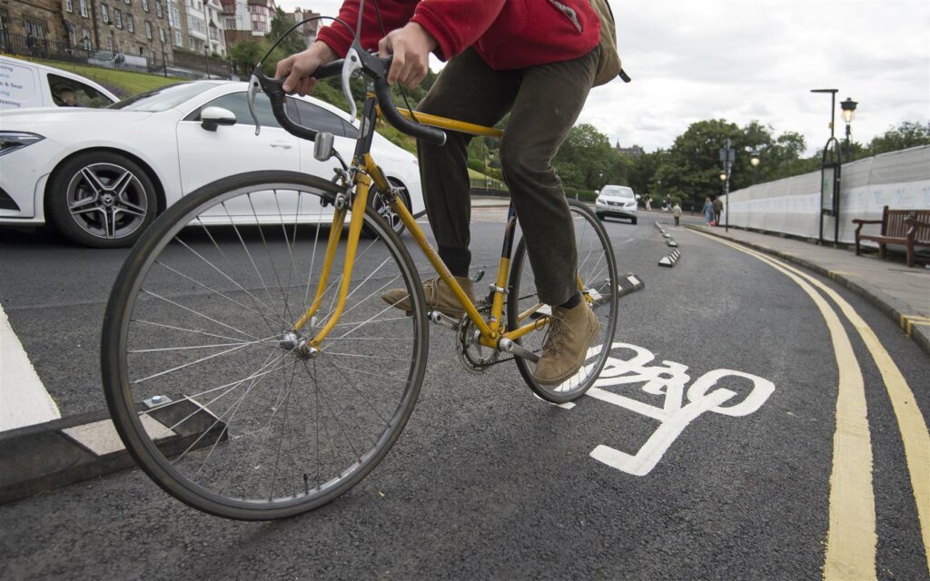
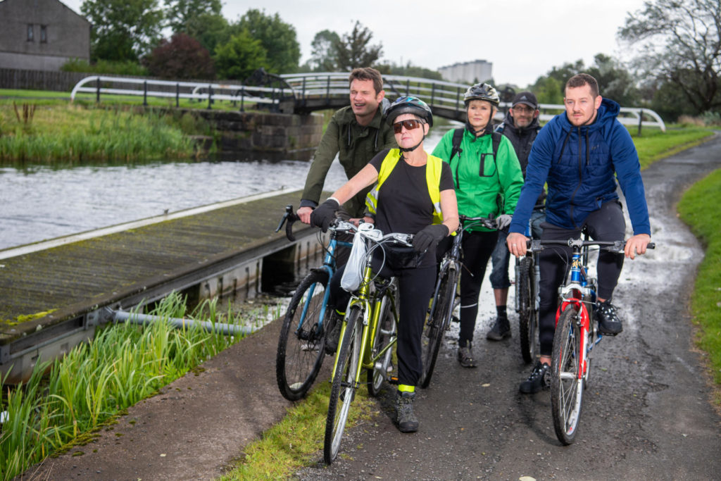
The Spaces for People programme provided Scottish local authorities £38.97 million to create temporary infrastructure for walking, whee;ling and cycling as part of the Covid-19 recovery. John Linton/Sustrans
What do I need to do now?
Category 1-3 projects already at construction stage: Please submit a project update form on the application portal detailing any increased funding request. Where these increases are solely attributable to the increase in intervention rate they will be automatically approved. Should you be requesting increases in funding for any other reason, please include a change control with the form.
Category 1-3 projects at design stage: Pleaseincrease your forecast construction request the next time you provide Places for Everyone with an updated programme and spend profile; this will likely be at the next stage review for your project.
Category 4 projects not yet approved by Panel: Please follow the previous recommendation for category 1-3 projects. Those partners who are about to submit to Panel should ensure that their submission documents reflect any increase in grant request.
Category 4 projects Approved by Panel and other legacy projects in receipt of multi-year funding: Where there is an existing budget or programme revision awaiting approval, please submit revised financial information to the portal via a project update form and both these figures and any previous figures provided will be presented to a Change Control Board alongside your existing change control. If you are not otherwise waiting for approval, please submit a revised grant request via an update form and this increase will be approved.
Neil Hanna Photography
www.neilhannaphotography.co.uk
07702 246823
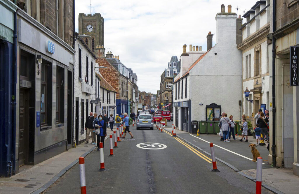
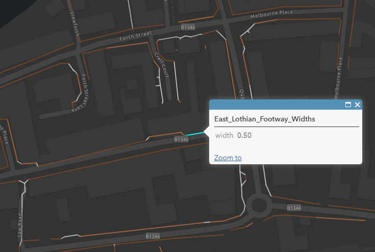
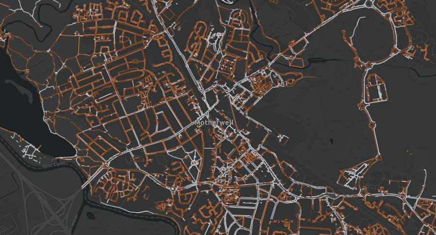
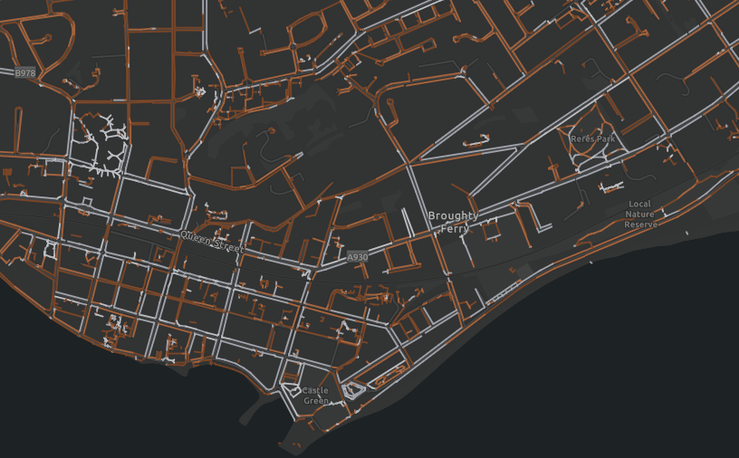
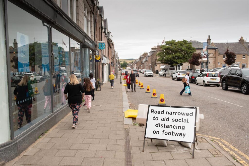
Mapping pavement widths can help local authorities identify pinch points in urban centres or where physical distancing is otherwise unachievable. High Street, North Berwick. Neil Hanna/Sustrans
Responding to a crisis
With the advent of the Covid-19 pandemic, the scarce amount of space allotted to people across Scotland’s towns and cities is firmly in the forefront.
Attempting to maintain a two-metre physical distance from other pavement users whilst navigating by foot or wheel can be a nuisance at the best of times and an impossibility at others.
In aid of this, Sustrans’ Spaces for People programme, funded by the Scottish Government, has distributed almost £40 million to local authorities to provide temporary infrastructure to help people walk, wheel and cycle.
Spaces for People is delivering temporary infrastructure throughout Scotland to help people walk, wheel and cycle safely through the Covid-19 pandemic. Forrest Road, Edinburgh. Sustrans/Neil Hanna
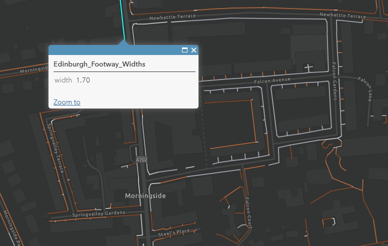
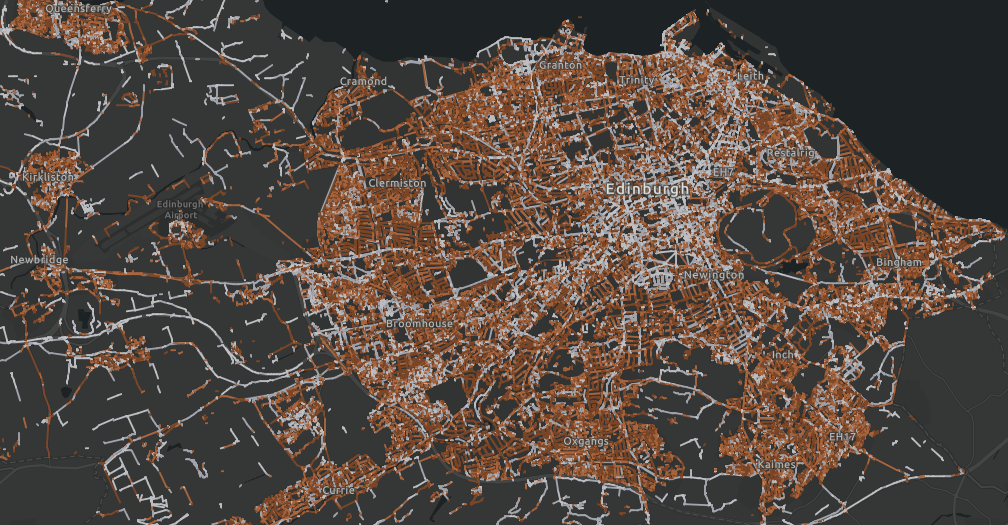
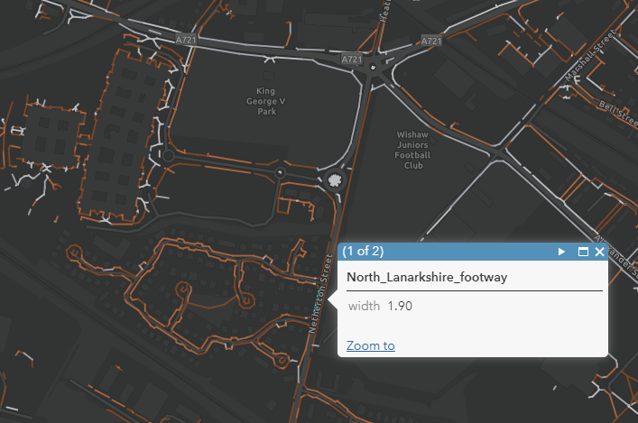
With a common bid by local authorities’ being to widen public footways, Sustrans have set to calculate and map pavement widths in towns and cities through Scotland to help identify potential crowding pinch points and support physical distancing.
Early mapping in Edinburgh
In 2010, City of Edinburgh Council began work on developing an Active Travel Action Plan, a long-term city-wide project to improve the accessibility and safety of walking, cycling and wheeling infrastructure.
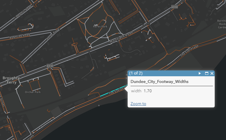
One of the ways Sustrans has been assisting the council with this ambitious project is by undertaking the painstaking work of mapping individual pavement widths throughout the city.
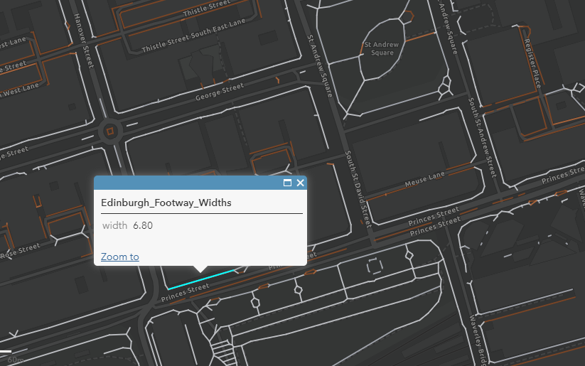
Princes Street allows 6.8m of pavement width. However, for such a busy street this often is not enough
Morningside Road has been widened with traffic wands in several locations in order to bolster the 1.7m width the pavement currently allows for.
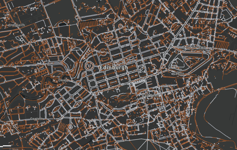
Edinburgh is an historic and densely packed urban centre within which pavement widths vary greatly.
With physical distancing guidelines now in effect as a matter of public health, the construction of a working pavement width database for the whole of Scotland has taken on a new urgency.
Once lockdown was announced, Sustrans accelerated work on providing City of Edinburgh Council with a comprehensive dataset of pavement widths.
This was achieved by adapting code developed for New York to complement Ordinance Survey data.
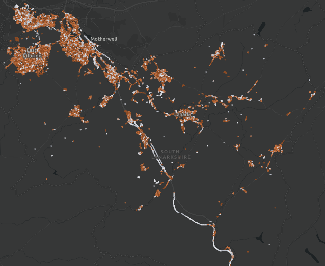
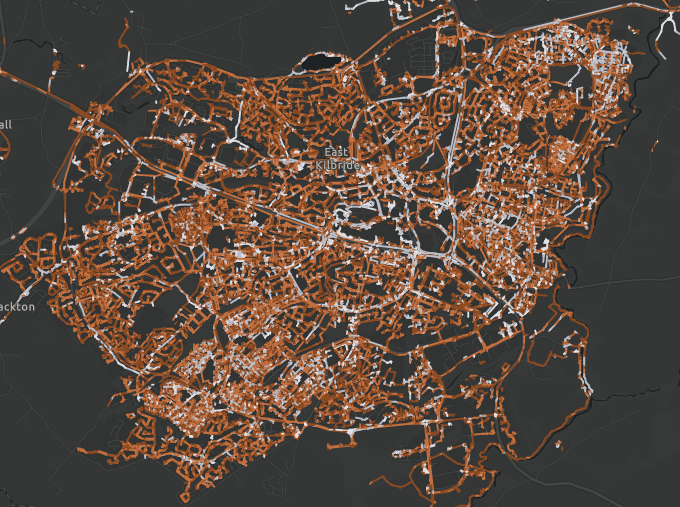
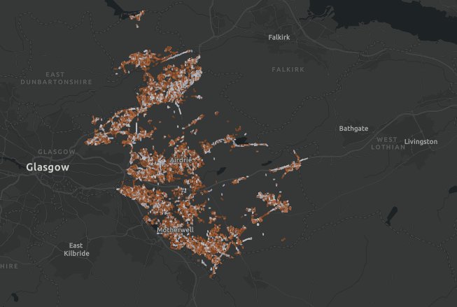
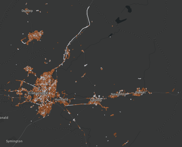
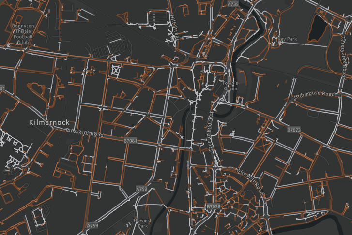
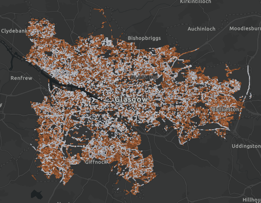
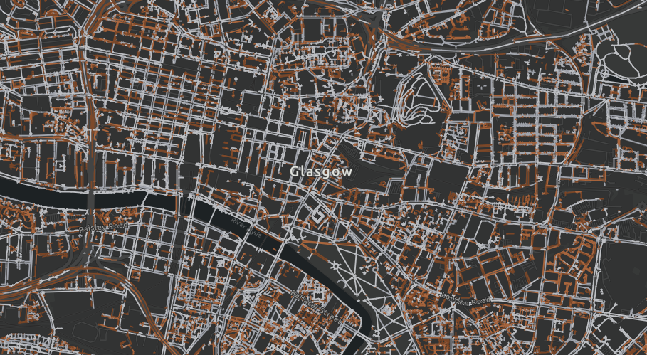
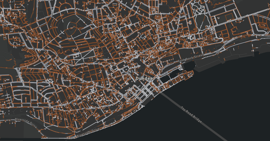
From this initial success, Sustrans has been able to develop further datasets for Glasgow, East Lothian, Dundee, East Ayrshire and South Ayrshire, with the offer being extended to any other local authorities who would find such data useful.
The coding process
Infrastructure Coordinator for Sustrans Alasdair Anderson was a key player in developing the mapping datasets. As lead on the project, he explains:
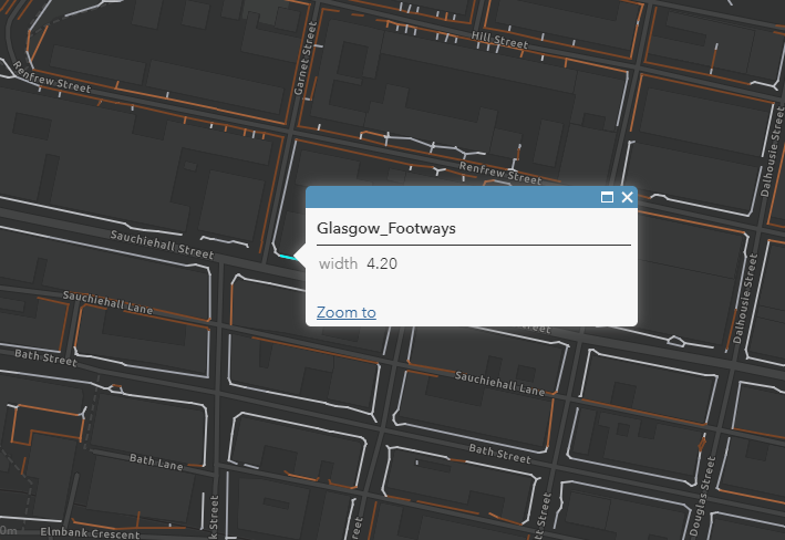
“The Python code used to do the analysis utilised Ordinance Survey’s most detailed Mastermap Topograpic Area mapping.
This identifies pavements and paths within a given local authority and accomplishes the surprisingly difficult task of measuring the width of an irregularly shaped object by using a tailored algorithm.
By first calculating the centreline for each of the thousands of bits of pavement that have already been identified, the algorithm then measures the distance back from individual pavement centre point to the pavement edge to calculate the width.
Finally, the results are compiled into a GIS dataset which can be analysed statistically or displayed on a map”.
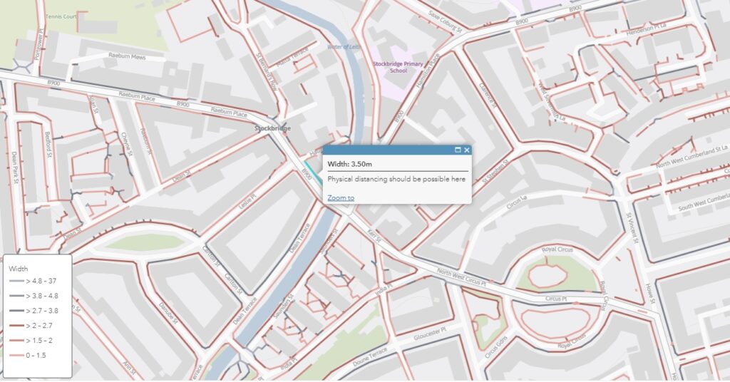
Even Edinburgh’s busiest shopping streets have very narrow pavements. Raeburn Place, Stockbridge. Ordinance Survey.
Using the data
An immediate benefit of this data is that it can be used to help people navigate routes which only follow wider pavements.
For example, Sustrans officers have been looking to use pavement widths data to enable them to plan led walks with volunteers or school children once lockdown restrictions are sufficiently eased.
The larger impact, however, of these mapping capabilities is apparent when the data is combined with other information in order to identify the narrowest or busiest streets in order to prioritise them for widening interventions.
While the £38.97 million available under the Spaces for People fund is a lot of money, it is not nearly enough to widen every pavement in Scotland. As such, working out how to prioritise pavement widening initiatives becomes crucial.
Pavement distancing description
Width
km
%
Easy
>4.7m
133.97
4
Comfortable
3.8 to 4.7m
105.93
3.1
Possible
2.7 to 3.8m
362.75
10.7
Difficult
2 to 2.7m
608.84
18
Too narrow
1.5 to 2m
975.01
28.9
Less than minimum design guidance
<1.5m
1192.8
35.3
Total ‘difficult’ or narrower
<2.7m
2776.65
82.2
Table demonstrating the widths of pavements throughout Edinburgh as they relate to physical distancing health guidelines.
Applications in Dundee
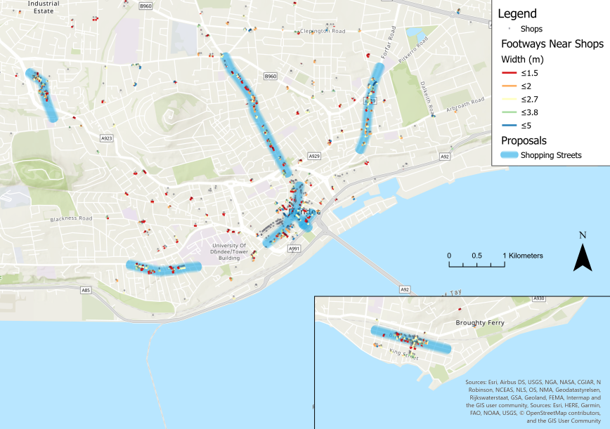
One of the first practical applications of Sustrans’ pavement mapping capabilities took place in Dundee city centre.
While nearly empty during lockdown, Union Street in Dundee has been closed to traffic in anticipation of crowds of people returning as businesses reopen. Union Street, Dundee. Paul Reid/Sustrans
A dataset of shops and services in Dundee was first created. This was then overlaid with the footway width dataset Sustrans had created to help identify narrow pavements where high footfall was likely to occur. From this, a unique set of Covid-19 emergency proposals for shopping streets in Dundee was able to be generated.
Using these emergency proposals, Sustrans was then able to highlight particular areas where it would be most crucial to prioritise pavement widening interventions.
Areas in blue are streets which would most benefit from widened pavements. Similar approaches have now been utilised in Edinburgh and East Ayrshire.
Looking forward
Looking beyond the Covid-19 pandemic, the datasets Sustrans has created provide local authorities with an invaluable resource with which to maximise the benefit of footway renewal programmes.
Initial progress can be made by first focussing on pavements which fall short of 1.5m, normally considered to be the minimum.
Interventions in areas such as these would improve accessibility for those with additional mobility support needs immensely, such as those manoeuvring a wheelchair or a pram.
Recent adaptations in the code used to calculate pavement widths have now enabled Sustrans to calculate the widths of entire streets.
This new capability could be instrumental in helping Scottish local authorities understand where it would be most beneficial to deliver cycling infrastructure in the future.
Gallery
Take a look at some of the Scottish towns and cities Sustrans has created GIS pavement width maps for in the image gallery below.
A combination of Spaces for People and Places for Everyone initiatives will help safeguard the school run as a safe and enjoyable commute. Sustrans/Julie Howden.
Schools throughout Scotland have been largely closed since the beginning of March due to the Covid-19 pandemic.
Now, with their imminent return this month, temporary measures are being introduced through Spaces for People in order to safeguard the health of pupils, parents and teachers, as well as wider communities.
Forward thinking
Due to the increased hesitance around the use of public transport, concerns have been growing that school access roads could quickly become congested with parents attempting to drop off and pick up their children from school.
As well as contributing to the poor health outcomes that are associated with stationary vehicles, pavement parking would greatly reduce the footway space available to path users for physical distancing.
This, ultimately, could increase the likelihood of transmitting Covid-19 within the community.
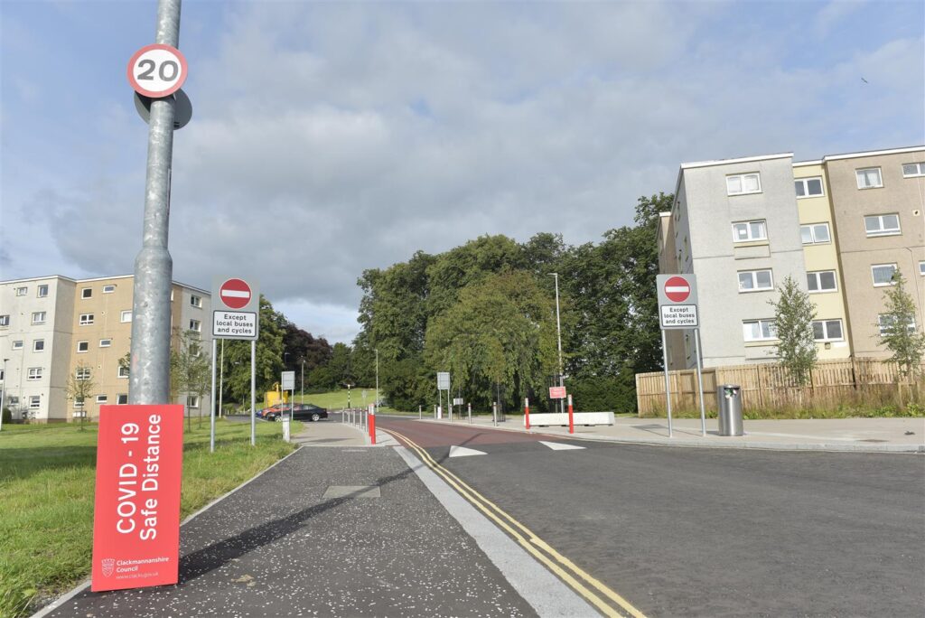
Taking steps to prevent this, Clackmannanshire Council, supported by Sustrans, have allocated a portion of their Spaces for People funding to ensuring that the school run is still enjoyable and safe
Lamp post wraps and floor stencils have been installed in the area surrounding Abercromby Primary School to improve vigilance of public health guidelines. Sustrans/Julie Howden.
These plans include restricting through traffic to buses and cyclists on The Orchard, Tullibody, an access road to Bernadette Primary School.
As well as promoting a healthy and active commute to school, reallocating road space will allow pupils to walk, wheel and cycle to school with the space they need to maintain physical distance.
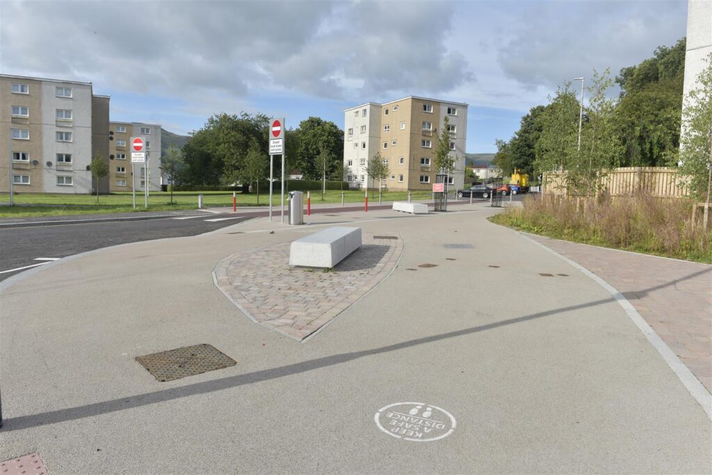
As well as this, Covid-19 messages that remind path users of the importance of maintaining a safe physical distance have been installed on pavements using spray painted stencils.
Lamp post wraps and bolted on street signs have also been introduced.
Permanent solutions
Through Sustrans’ Places for Everyone programme, large pencil-shaped bollards have been erected along The Orchard as part of a wider School Street project undertaken during a refurbishment of the school building.
Trees and comfortable seating areas have also been introduced to offer waiting parents a distanced but convenient alternative to gathering outside of the school gate.
Seating areas outside of the school will ensure parents have a comfortable place to wait away from the school gates. Sustrans/Julie Howden.
Where traffic cannot be restricted, fixed installations such as these increase driver awareness of their presence in a school zone and also provide an effective deterrence to mounting the kerb.
Some emergency measures proposed by Clackmannanshire Council as part of their Spaces for People application have already been fast-tracked towards becoming permanent.
Over the coming years, the informal walking, wheeling and cycling links that currently links Sauchie and Glenochil with the nearby Lornshill Academy will be upgraded through the Place for Everyone School Street project into a permanent shared-use path.
This will not only encourage children and parents to stay healthy and active whilst commuting to school, but also improve air quality and safety in the surrounding area.
“Clackmannanshire are making the school run safer, cleaner and more fun for all. Their ambition to prioritise active travel is evident in their Places for Everyone projects and remains at the heart of these Spaces for People interventions. Over the coming years, we will continue to support Clackmannanshire improve school journeys for all.”
Andrew Scoles, Infrastructure Officer, Sustrans
For more information on Clackmannanshire Council’s Space for People project click here.
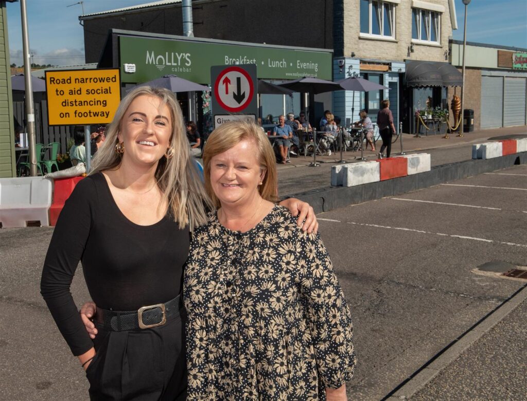
Aberdeen , Scotland, Friday, 7 August 2020
Pictured is Janice Langdon, the owner of Molly’s Cafe in Stonehaven with her daughter Megan Ann Langdon, the cafe’s manager.
Picture by Abermedia / Michal Wachucik
Janice Langdon, owner of Molly’s Cafe and Bar, along with her daughter Megan Ann Langdon, the cafe’s manager. welcome the temporary changes. Abermedia / Michal Wachucik
For the better part of the last five months, businesses throughout the UK have been largely non-operational due to the public health crisis caused by the Covid-19 pandemic.
Whilst protecting public health, indefinite closure and reduced footfall has had a devastating impact on the livelihoods and future prospects of businesses, especially small and local owners.
The appetite for change
Stonehaven has a number of streets primed for high footfall, including Allardice Street, Market Square and The Links.
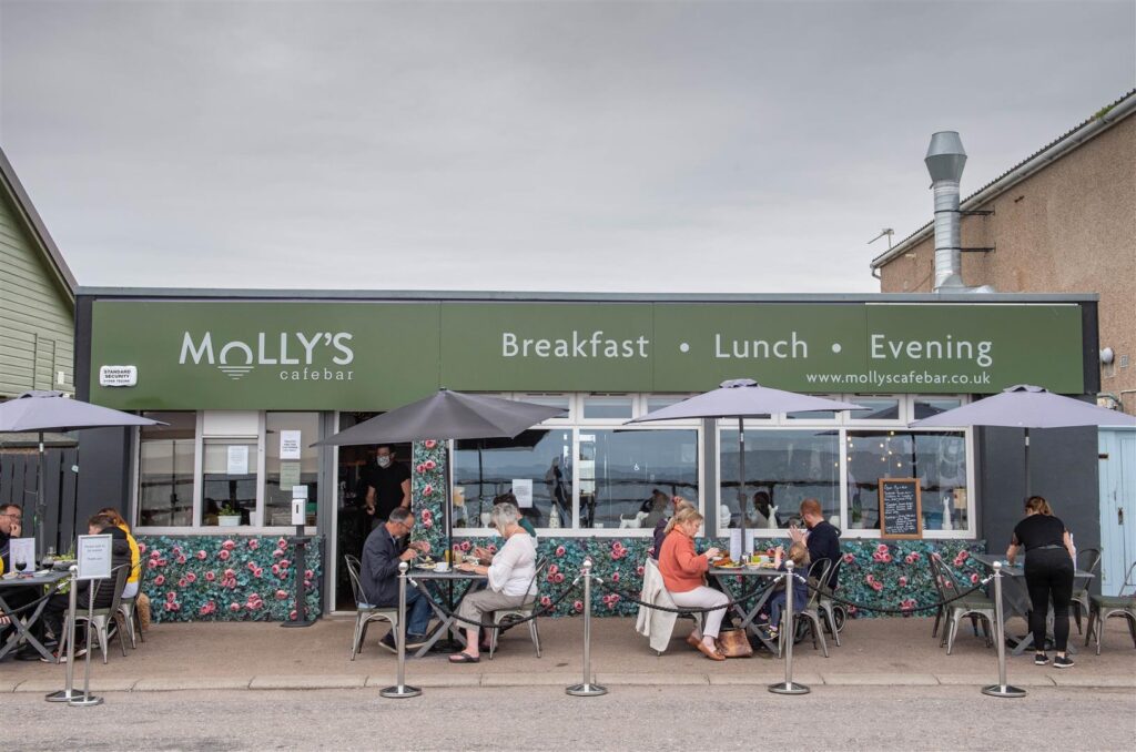
In each of these locations, car-parking spaces have been removed using cones and lengths of coloured separators in order to facilitate additional space for pedestrians to pass one another and queue outside of shops safely.
Pavements were widened using signage and cones at Market Square, Stonehaven, to allow people to move around safely. Abermedia / Michal Wachucik
The Links, in particular, has benefitted from the Spaces for People interventions.
With car-parking spaces removed, customers are now able to queue safely outside of local cafés and eateries, and enjoy expanded seating areas with an unrestricted view of the bay.
Janice Langdon, Owner at Molly’s Café Bar, was delighted by the interventions.
“Without the change of layout to the road, I would not have been able to open the business safely due to the constant queues from another business next door. All of our customers, old and new, comment about how safe they feel with the set-up we have outside. Covid-19 has had such a negative effect on people but this set-up, I must say, is all positive. People are so delighted to be getting out again and to make them feel safe is our priority.”
Janice Langdon, Owner, Molly’s Cafe and Bar
Businesses like Molly’s Cafe and Bar have been able to resume business safely by using reallocated road space to serve customers outdoors. Abermedia / Michal Wachucik
Equally, Nicci Dollar who owns Aunty Betty’s, a popular ice cream shop along The Links, has felt supported by the changes.
“We’ve found the changes to be wonderful. The changes at the beachfront have allowed us to create a queuing system and safe area for the public and our staff. We wish for this to be a permanent feature at the beachfront.”
Nicci Dollar, Owner, Aunty Betty’s
A coordinated effort
Following the award of Spaces for People funding, Sustrans worked closely with Aberdeenshire Council to develop a suite of appropriate temporary measures which were also conducive with physical distancing guidelines.
Parking has been temporarily removed and pavements widened on Banchory High Street to give more people space to physically distance. Abermedia / Michal Wachucik
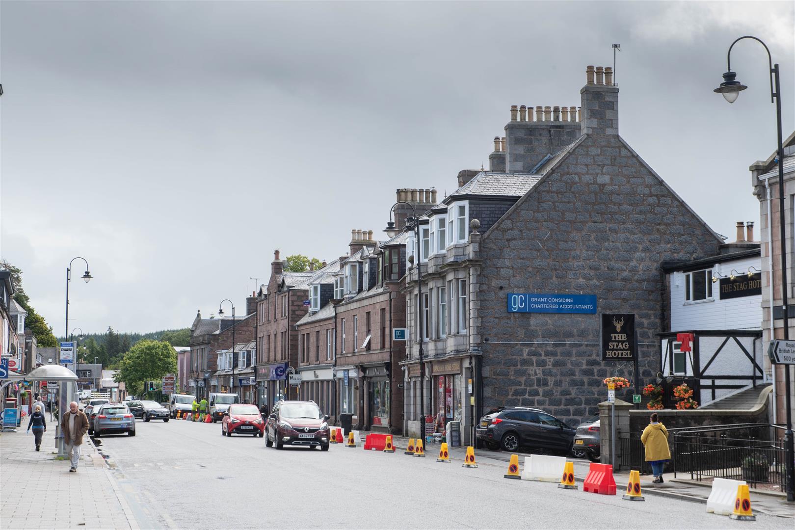
The key urban centres of Stonehaven, Banchory, Inverurie, Ellon, Fraserburgh, Peterhead and later Turriff were identified as areas which would benefit most from these measures, with changes having been rolled out from July 15th onward.
Now in effect, temporarily widened footways and one-way traffic flows allow pedestrians the space needed to move around, shop, visit essential services and enjoy their local areas whilst maintaining a safe physical distance.
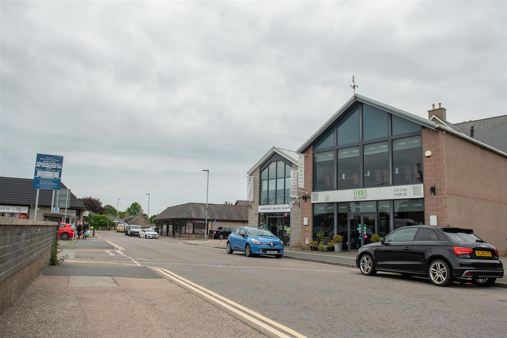
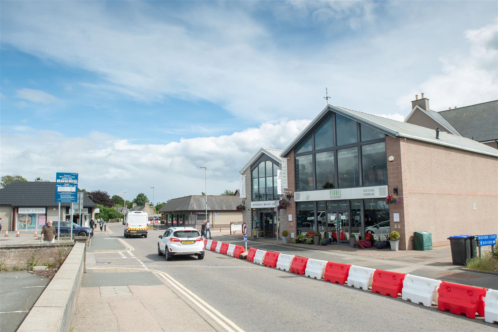
Temporary physical barriers on Burn Lane, Inverurie, will help provide space to shoppers once footfall returns. Abermedia / Michal Wachucik
Bonnie Thomson, Infrastructure Coordinator at Sustrans, has been overseeing the Aberdeenshire project since it was annouced.
We are delighted to see the temporary measures that have been introduced throughout Aberdeenshire. These changes will allow residents to complete essential journeys and access vital public services safely and with peace of mind.
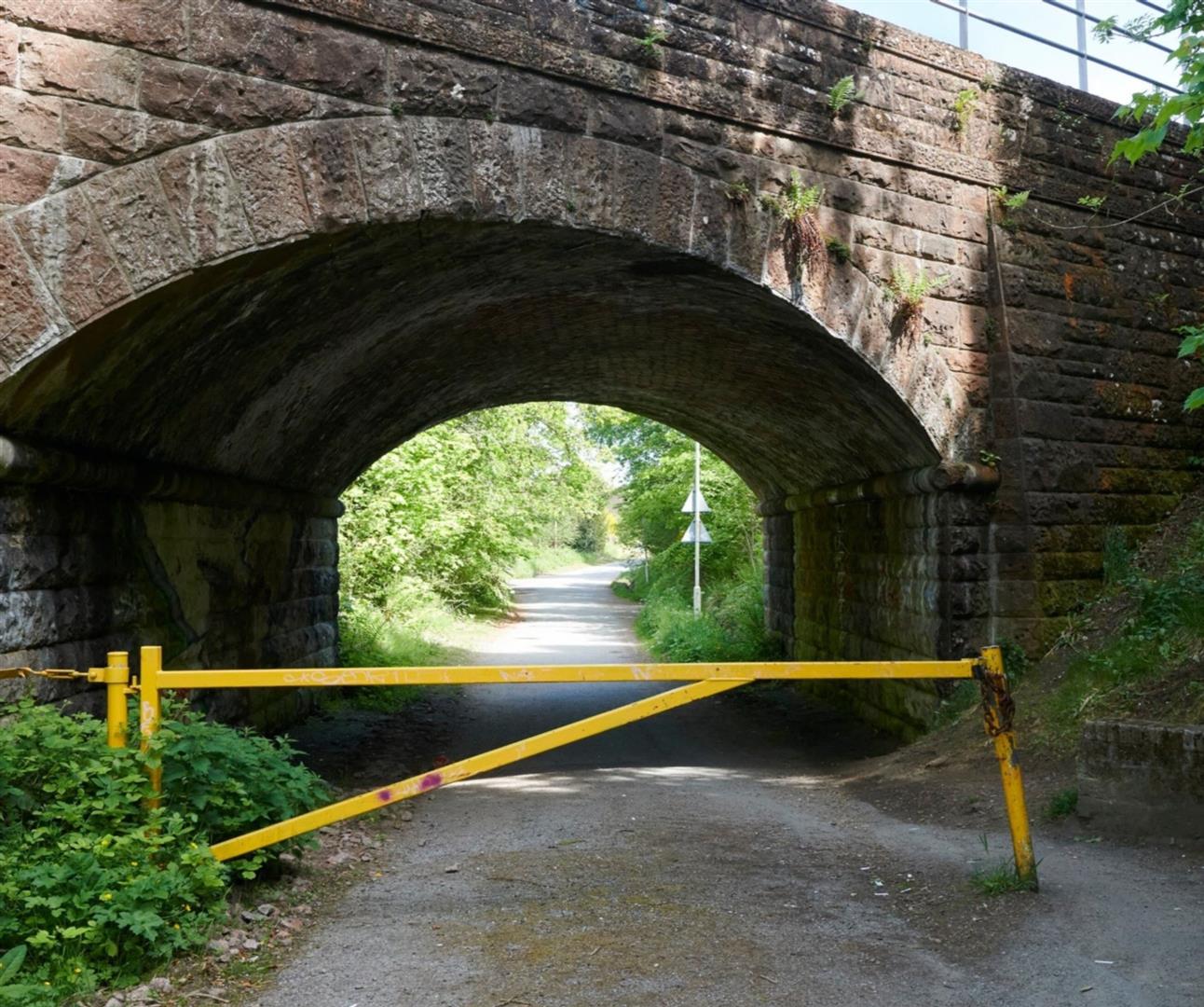
Physical barriers and space-limiting infrastructure, such as narrow footpaths, metal fencing and overgrown vegetation are normally no more than a minor nuisance to people travelling on bike or by foot.
But, because of Covid-19, they have become a major public health concern, as they make it much harder for people to physically distance when out and about.
However, for those with additional mobility needs, this kind of infrastructure has always been an issue. And, whether steering a pram, a cargo bike, or a wheelchair, for many, trying to navigate these kind of obstacles can be a major barrier to a simple journey.
Breaking down barriers
Through Sustrans’ Space for People programme, councils across Scotland have been addressing this problem. Many physical obstructions on walking and cycling routes have either been replaced with more accessible designs, or removed altogether
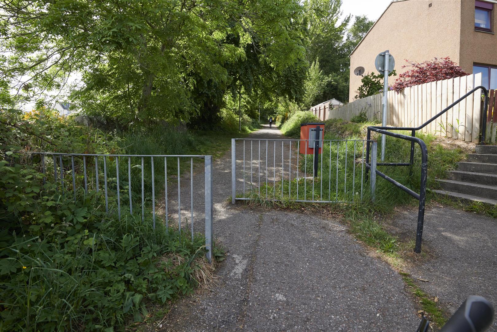
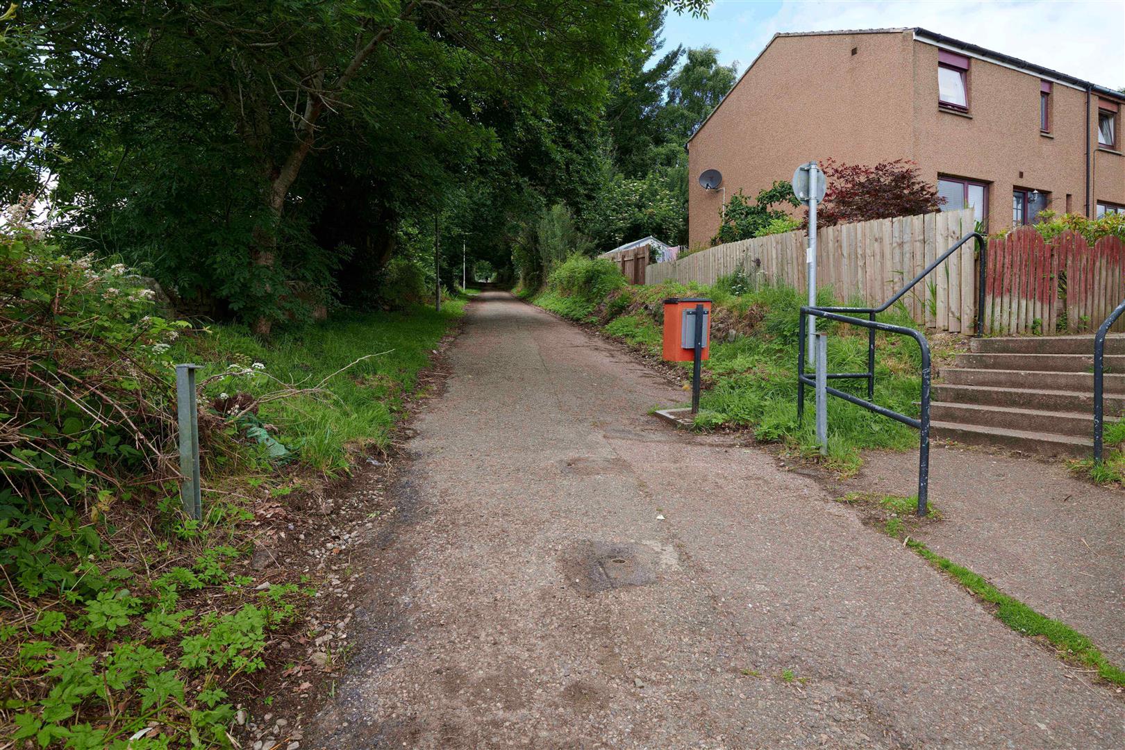
In Inverness, the Highland Council, identified a number of these barriers along busy active travel commuting routes to the city centre.
Gate removed from Caulfield Road North (left) and the bollards installed in its stead (right). Sustrans/Ewen Donaldson
They included Caulfield Road North, to the east of the city centre. This road links suburban communities with a number of essential services, including Raigmore Hospital, Insches Retail Park and the Inverness Campus.
The council replaced a large yellow gate with brightly coloured bollards in Resaurie, to make it easier for people to walk, cycle and wheel along the route.
Meanwhile, at the other end of Caulfield Road North, at the entry way to Cradlehall Business Park, the council added a dropped kerb in the pavement. This has helped create a smoother and safer crossing point for all users.
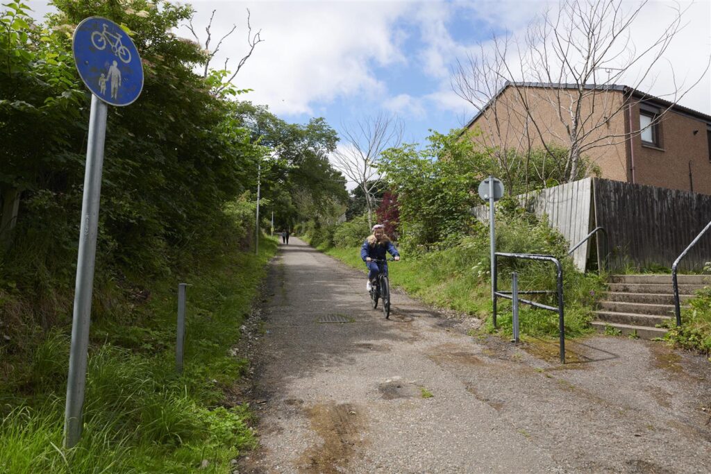
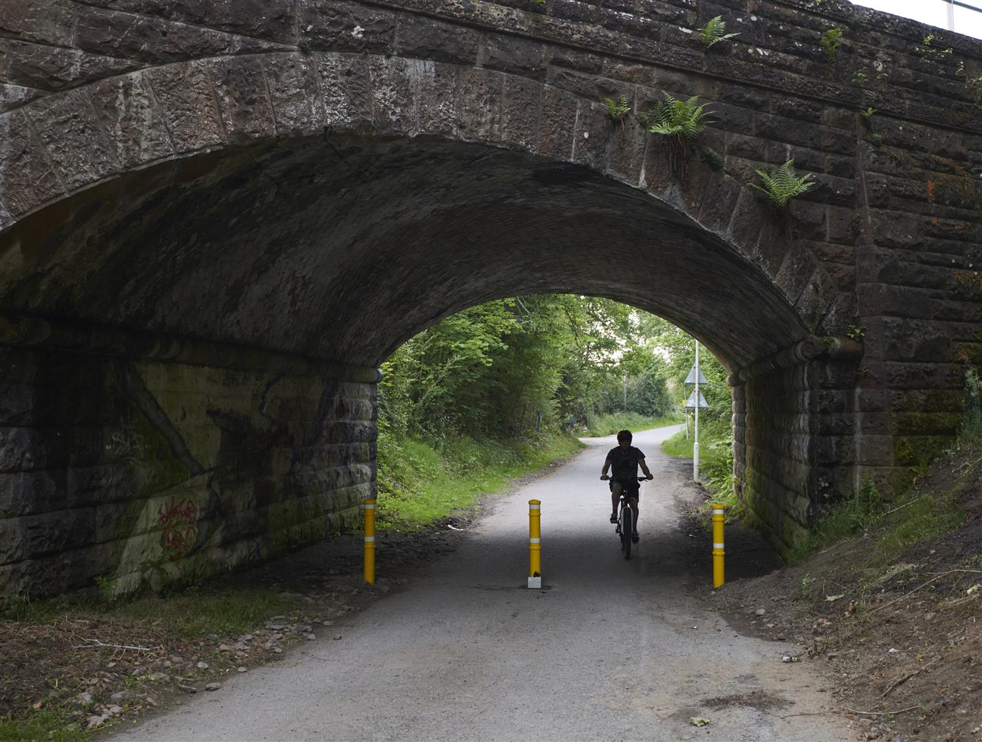
Kinmylies Way with metal barriers and overgrown vegetation (left) and after removal (right). Sustrans/Ewen Donaldson
Similarly, to the west of the city centre, Kinmylies Way, a busy walking and cycling route with commuters had become overgrown with vegetation and was marred by imposing intermittent metal fencing.
This created a series of uncomfortable pinch points for path users. It also made it harder for people with cargo bikes, prams or wheelchair users to travel along the path.
The council removed lengths of metal barriers and broadened gravel paths. They also cut back vegetation, including tree cover which reduced the areas visibility. It is now much easier and safer for users travelling along the route.
The future is accessible
These small changes are not only cost-effective for local authorities but quick to apply, making them ideal for Spaces for People projects.
Most importantly of all however, is the difference they can make to how people move around their local areas and make every day journeys.
Find out more about the Highland Council’s Spaces for People project here.
This piece is part of a series on the South City Way Small Grants Fund. This fund was created to inspire community groups and charities to design artworks and gathering places which encourage walking and cycling. Find out more about the South City Way.
In recent years, significant media attention has focussed on the perceived and often real cultural tensions that are seen to be present in the Govanhill area of Glasgow.
In an effort to combat this and foster new community-led integration, Govanhill Baths Community Trust (GBCT) launched a successful application with Sustrans’ Places for Everyone programme, through the South City Way Small Grants Fund.
A Diverse Picture
Led by GBCT, and delivered in partnership with Southside Studios, Locavore, Romano Lav, Annette Street Primary School & Cuthbertson Primary School, the Govanhill Arts Regeneration Network (GARN) proposes a number of high profile public art pieces be installed in key sites around Govanhill in order to reflect the unique cultural diversity of the local area.
Initial designs for the installations were developed following a wide-ranging community consultation, including a charrette, in order to ensure the proposals were inclusive, as well as to facilitate a sense of ownership.
The four installations that were ultimately agreed upon will be located at various points along Victoria Road, the key route of the initial leg of the South City Way.
The Bowman Street Mural, situated at the intersection of Victoria Street and Bowman Street features images designed by the Govanhill Youth Club on the theme of cycling and urban landscape.
The imagery was created by the young people with the aid of design and workshop sessions facilitated by local artist Amelia Rowe.
“I think murals like this are important because they’re accessible to everybody, everybody sees them when they’re going about – they’re free.”
Amelia Rowe, Artist
Nadine Gorency, who led The Bowman Street Mural project on behalf of the GBCT, has been a vocal supporter of community-building initiatives such as this one which could help to promote greater integration in the Govanhill Community.
“The Bowman Street Mural celebrates the diversity of Govanhill with the local community through the arts as well as provide colour and vibrancy to the cycle lane which will in turn encourage cycling, health and wellbeing in Govanhill.”
Nadine Gorency, Project Manager, GBCT
In addition to fostering strengthened social ties, it is hoped the new mural will serve as an attractive rest opportunity for cyclists on the South City Way, increasing support for the local economy whilst also providing a safe cycle route to the city centre.
The finished mural at The Barn youth space on Abbotsford Place.
Run by Crossroads Youth & Community Association, The Barn is a space for young people in Laurieston and the Greater Gorbals to relax, have fun and receive the support that they need.
Youth Workers at the charity had been looking for a bold and creative way to make their organisation a destination point, in a way that also included the local community.
Their application to the South City Way Small Grants Fund proposed installing an artwork designed by young people in the area on at the front of their building.
Creative Planning
Created to inspire local community and charity groups to propose new gathering places and artworks along Glasgow’s South City Way, the Small Grants Fund offered these groups the chance to apply for a share of over £100,000 to fund their projects.
The funding inspired local young people to tour the murals and street art around Glasgow in order to develop their own ideas. This took them along cycle paths and into unfamiliar parts of the city that they wouldn’t usually see.
The group then put their designs together for the new collective artwork on Abbotsford Place. A local artist was recruited to help with this process as well as to assist with spraying the final piece on the wall.
The finished collective artwork at the youth centre on Abbotsford Place.
The completed piece sees the community group’s name Crossroads and Youth Community Association spread across the wall against the backdrop of a pastoral meadow. A quote from the group’s founder, Geoff Shaw, is also included, and reads: “Everyone has the right to live gloriously!”
They also installed planters and bike racks at the front of the centre.
Local Impact
Crossroads and Youth Community Association youth worker Nick Miller, saw The Barn project through to completion from the start.
‘Now you’re just drawn to the building, and through that we’ve had people dropping in and grabbing teas and coffees. We’ve had people taking photographs of stuff, and just leaving a couple of pounds donation. So hopefully it just draws more people to the building’.
Nick Miller, Youth Worker, Crossroads Youth and Community Association
Sustrans Officer Michael Melton, is delighted with the enrichment of the South City Way.
“The Barn stands out now as a safe and creative hub for young people to gather. The mural is a really valuable addition to the South City Way route and a great example of exactly what the Small Grants Fund is for”.
Michael Melton, Infrastructure Coordinator
This piece is part of a series on the South City Way Small Grants Fund. This fund was created to inspire community groups and charities to design artworks and gathering places which encourage walking and cycling. Find out more about the South City Way.
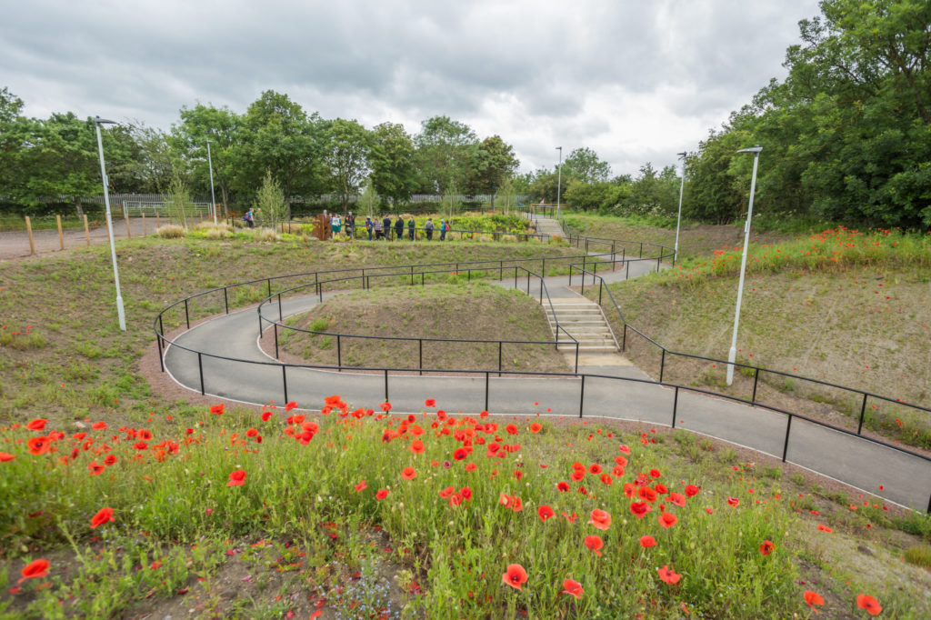
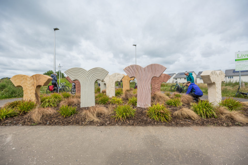
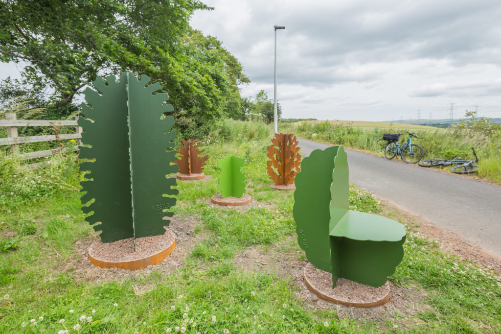
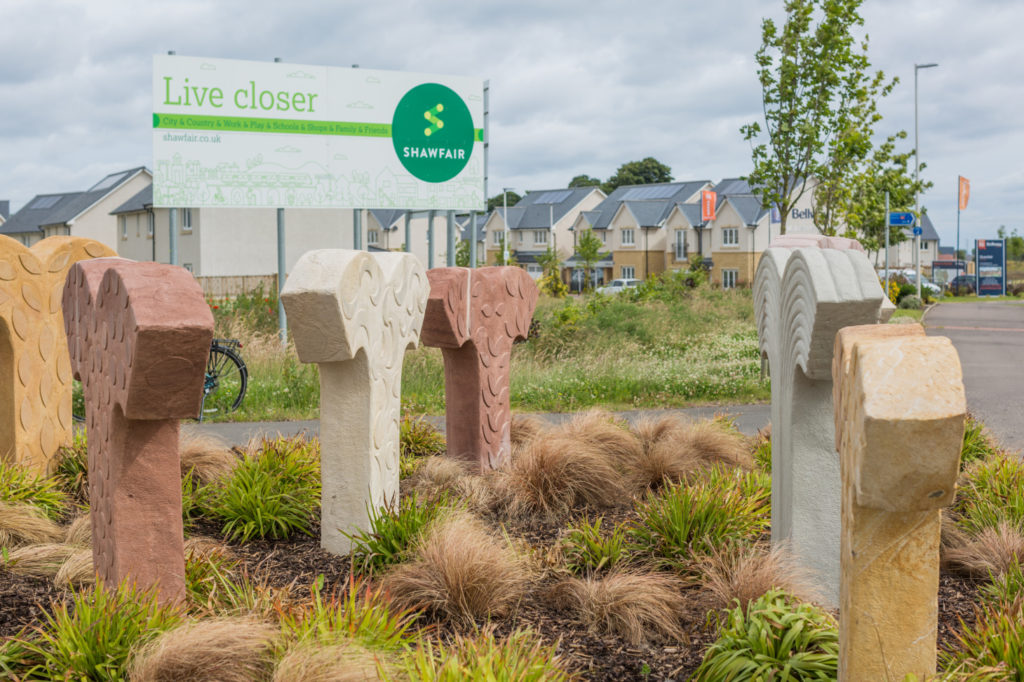
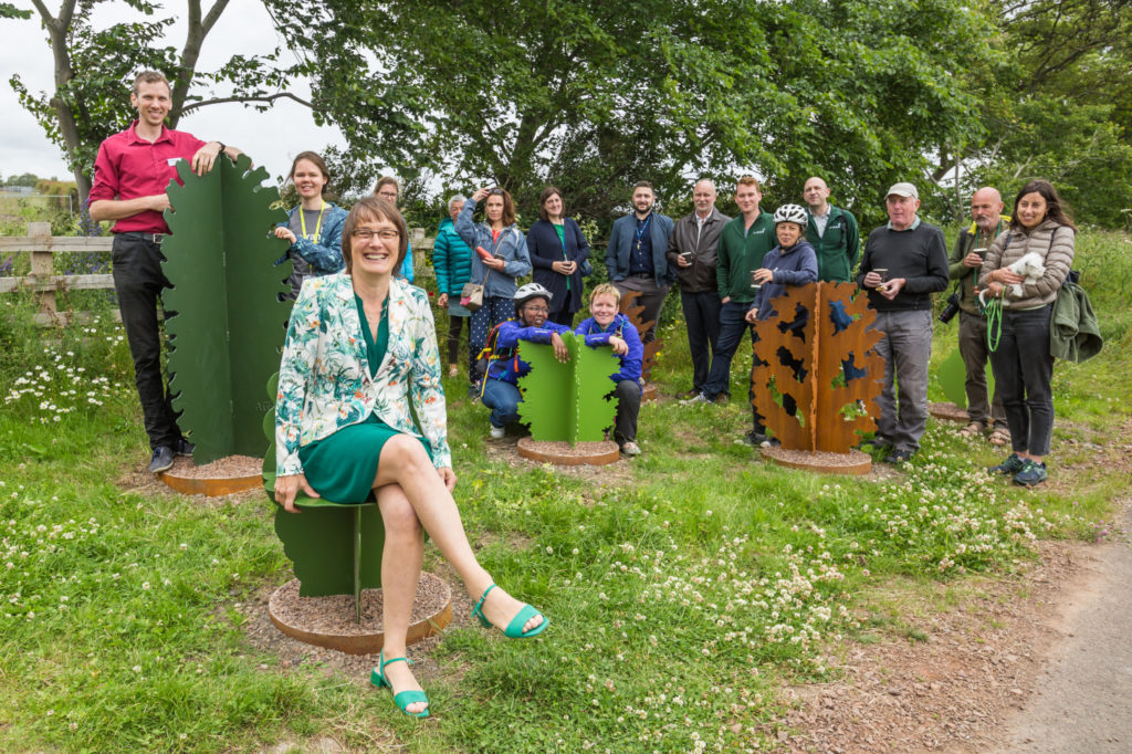
Project managed by Sustrans Scotland’s Engineering team, and delivered in partnership with City of Edinburgh Council, Midlothian Council and contractors, RJ McLeod, the project aimed to anticipate the travel needs of future residents of a new housing development set for construction along the former railway line.
By creating
arterial active travel infrastructure ahead of the housing development,
Sustrans’ aim was to anticipate and shape the travel and leisure habits of
future residents to the area.
The resulting 3km
traffic-free route connects residents with local amenities including shops,
schools, the train station and park and ride.
Sustrans’ engineering team project managed the installation a ramp link to Gilmerton Road, similar to the ramp at Old Dalkieth Road, alongside artworks at two locations.
It has also
raised the profile of some of the fantastic commuter routes to Edinburgh City
Centre that residents can now take advantage of.
The creation of
the Loanhead Path Extension, was funded by Scottish Government through Sustrans
National Cycle Network Development Programme.
The artists were
selected based on their experience in public sculptures, their skills in
involving members of the public with their projects and their fantastic initial
ideas for what to create for the sites.
The resulting
artworks have helped to increase the attractiveness of the route whilst
creating distinctive focal points for path users.
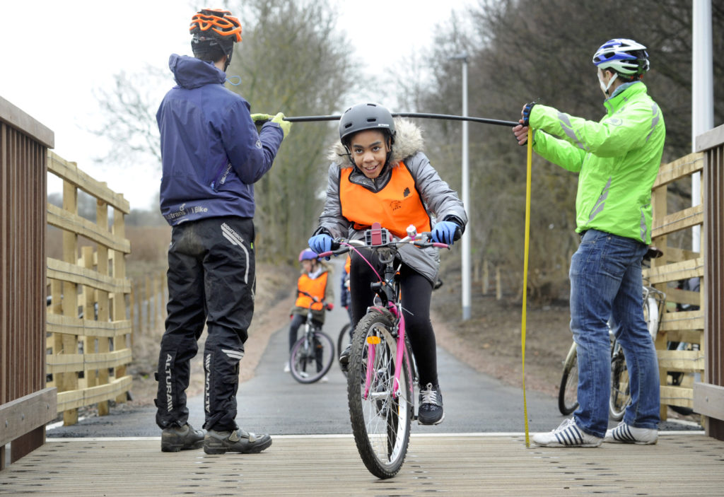
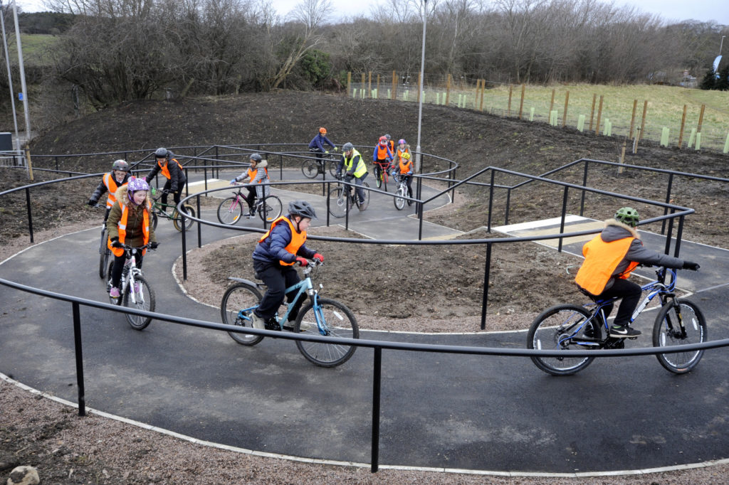
Working in partnership with Sustrans Scotland’s I Bike team in Midlothian, Sustrans’ engineering and schools team worked with Danderhall Primary School in Midlothian, to deliver STEM curriculum-based lessons for local school pupils on the route.
Sustrans’ engineering team provided learning on some of the engineering and maths required to help build the path and Sustrans Ecologist taught pupils about the range of wildlife and biodiversity on the route.
The Strathmore Cycle Network is an ambitious plan by three
Community Development Trusts to create a cycle network between Alyth,
Blairgowrie & Rattray, and Coupar Angus.
The idea of a traffic free path from Blairgowrie to Coupar Angus, giving locals an alternative to driving or using local bus services, was suggested at a Climate Café event in 2016. This spurred Alyth, Blairgowrie & Rattray, and Coupar Angus into applying for support from Sustrans’s Places for Everyone programme and regional transport partnership Tactran, with plans to deliver a phased network of walking and cycling routes between the three towns.
A Phased Approach
The first phase of the Strathmore Cycle Network was successful thanks to good engagement with local landowners. Working with the Development Trusts and with support from consultants Walking the Talk, they were able to apply to the Improving Public Access Fund, securing £200,000 for the construction of the first 2.5km of path link Alyth and Rattray.
The success of the plans boosted the community’s enthusiasm
for the project, and led to the development of phase 2; Blairgowrie to Coupar
Angus. The commitment of the volunteers in delivering the first phase impressed
Perth and Kinross Council and led to £100,000 funding contribution.
Having a supportive member of the Perth & Kinross’ roads team on the steering group also proved invaluable. The officer was able to positively feedback to other officers in the Council, and offer support and expertise to the Development Trusts to ensure the project progresses smoothly.
Engaging the
Community
Support from the Sustrans Places for Everyone programme and
Perth & Kinross Council allowed the development trust to appoint the Scottish
Community Development Centre to engage the local community. The initial route
chosen by the Trusts was locally unpopular but by involving a neutral third
party, the Trust were able to make sure there was an objective engagement
process.
The engagement sessions worked well; two main route options
emerged. Further discussion is on-going in an attempt to avoid a steep
gradient, with the Trusts committed to work with the community and Sustrans to
identify the best option. As there has been such positive public involvement so
far, there is a strong willingness to find a solution and create this key part
of the network
Successful
Partnership Working
The benefits of a Local Authority supporting in a community-led
infrastructure project can be considerable. Many groups have huge amounts of
enthusiasm and local knowledge to take projects
such as the Strathmore Cycle Network forward.
Development Trusts can be well placed to lead walking, cycling and wheeling projects. They are embedded in the community and often have experience of handling grant funding, working with elected members, and planning processes. Having multiple partners involved can open up additional funding potential. Each of the three Trusts has received grant funding for support activities, including staff time. This was a very deliberate move by the Trusts, and is a reflection of the strong working relationships that they have built. The model used by the three trusts could benefit many rural or sub-urban communities with poor connectivity.
Project representatives at Centre81, Whitecrook, Clydebank. The Community Centre, supported by the local authority, a local housing association and Sustrans have been working to design a new ramp to give the centre a direct connection to the Forth & Clyde Canal/NCN Route 754, allowing residents easier access to the centre and facilitating an existing programme of led rides and other activities on the tow path.
A cyclist arrives to join a led ride from Centre81
Inspired by residents’ reported barriers to walking and cycling, Clydebank Housing Association has been working to create a new accessible path between the Centre81 community centre and the Forth & Clyde Canal.
Working in partnership with Sustrans Scotland, Clydebank
Housing Association (CHA) established a steering group with local residents to
work out ways to encourage people to walk and cycle for more of their every-day
trips.
Residents suggested that creating an accessible route from Centre81, to the nearby canal towpath – part of National Cycle Network Route 754 – would help more people access the canal as well as local shops, bus links and other neighbourhoods along the canal.
CHA took on the task of working with the community to identify how best to design this path.
CHA made full use of its existing connections with groups throughout Clydebank. ISARO Social Integration Network – which works to promote integration and understanding amongst communities – provided support for the consultation, along with local disability groups, youth clubs and schools.
The honest feedback about the issues that visitors to Center81 faced on their everyday journeys gave CHA clear understanding of their needs and how they could be addressed through construction of a new access route.
Resources for
Behaviour Change
Funding from other sources can help spur interest in walking and cycling in the local area. A successful bid to Keep Scotland Beautiful’s Climate Challenge Fund saw CHA work to refurbish bikes for people in the local area and provide maintenance training so people could keep their bikes on the road.
Led rides and social cycles also began and finished at Centre81, taking advantage of the café and other facilities. The new ramp will give ride groups direct access to and from the canal, avoiding an alternative narrow path. This will give people new or returning to cycling a safe, off-road link to practice and ride freely on.
Designing links for everyone
An area of land at the side of Centre81 will be ravamped for the ramp
Inspired by their work with local residents, CHA and their designers created six designs for the ramp. Feedback also came from local stakeholders, including planning and roads officers at West Dunbartonshire Council, representatives from Clydebank Community Council and community officers from Police Scotland. Work with Scottish Canals and Sustrans Scotland ensured that proposals fitted with the requirements around the canal and the National Cycle Network.
Ensuring that local residents and users of Centre81 remained involved, CHA presented the six designs to the community, who voted for their favourite. The successful project was put forward to Sustrans Scotland for Places for Everyone construction funding.
Sustrans awarded CHA £170,000 through the Places for Everyone programme to finalise the technical design of the ramp and carry out construction. The option choose by the community will include local history, artwork, colourful tarmac and lighting to create an interesting new place. The school are keen to contribute by creating content to make this new space reflect the history and culture of Clydebank.
Key Learning
Staff from Clydebank Housing Association and Centre81 join a led ride
This project shows how partnerships with other organisations can create additional capacity and make smaller projects easier to deliver.
CHA staff were confident in engaging with their community, but had no experience of delivering an infrastructure project. West Dunbartonshire Council did not have the capacity to work in-depth with the community to develop a proposal for the canal ramp.
By pooling their knowledge and expertise, the two organisations were able to work together to create a useful route which meets the needs of local people and encourages them to travel by foot and bike.