Categories
Case Studies News News & Opinion Places for Everyone Project/Department Filtering

Opening the Loch Indaal Way

An opening event was held in October 2021, attended by local children from Port Charlotte Primary School with music provided by the Islay Pipe Band. Credit: ©2021, Islay Community Access Group, all rights reserved.

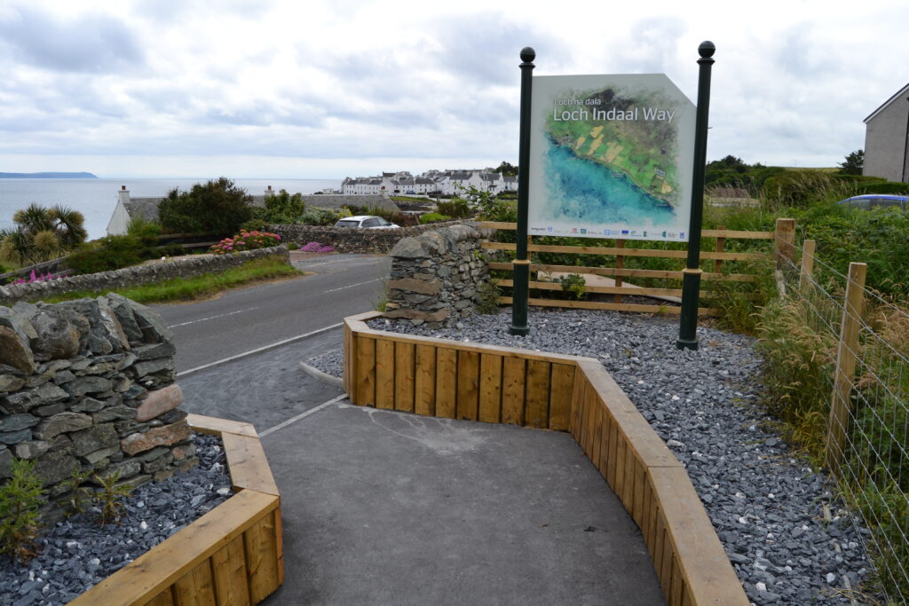
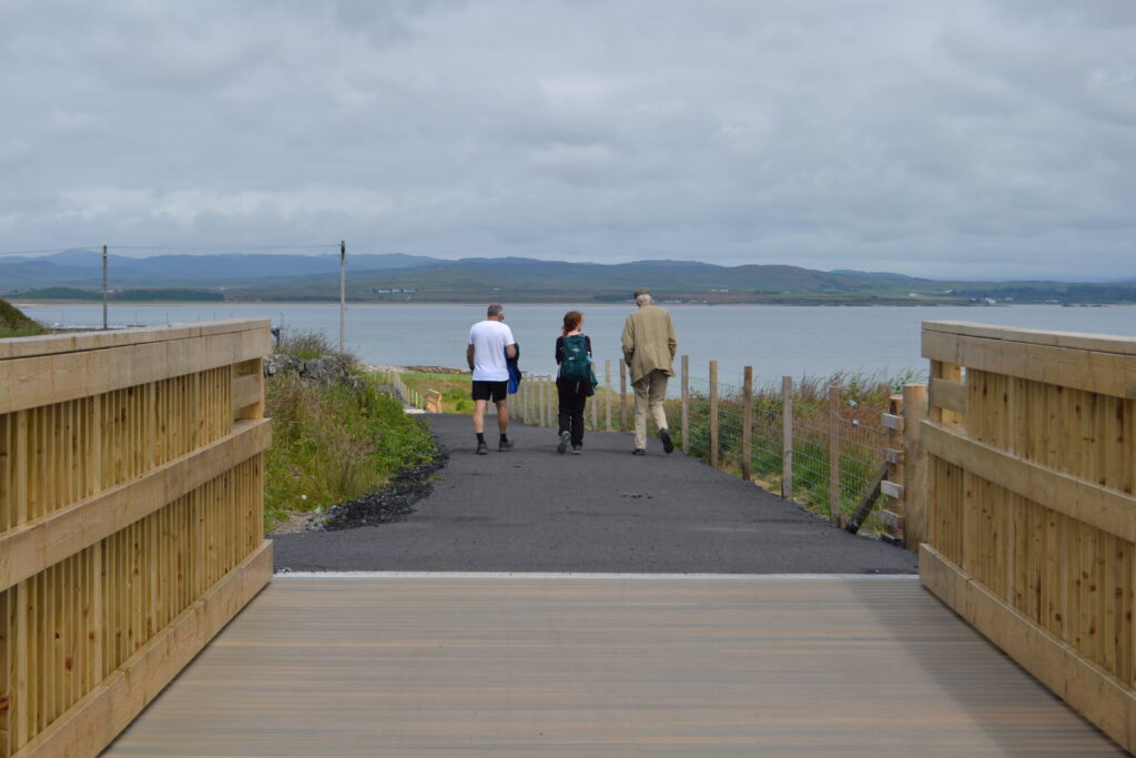
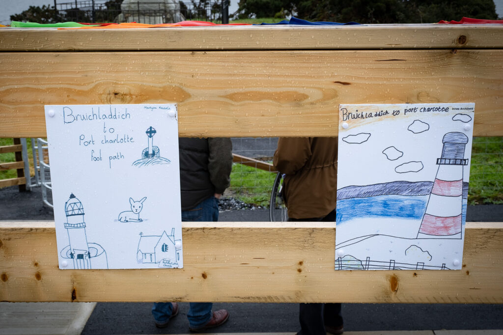
The Loch Indaal Way joins the communities of Port Charlotte and Bruichladdich via a safe, accessible and traffic-free route.

Prior to this, the sole existing link between the two communities was a section of the A847 carriageway, a national speed limit road which offers little protection to those walking wheeling and cycling on the island.

The newly completed off-road route has already proved popular with local residents and business owners, with its frequency of use expected to greatly increase when the tourist season returns.

Making waves in rural design

The Loch Indaal Way provides 2.53km of traffic-free route between the Islay communities of Bruchladdich and Port Charlotte. Credit: ©2021, Lisa Irvine/Sustrans, all rights reserved.

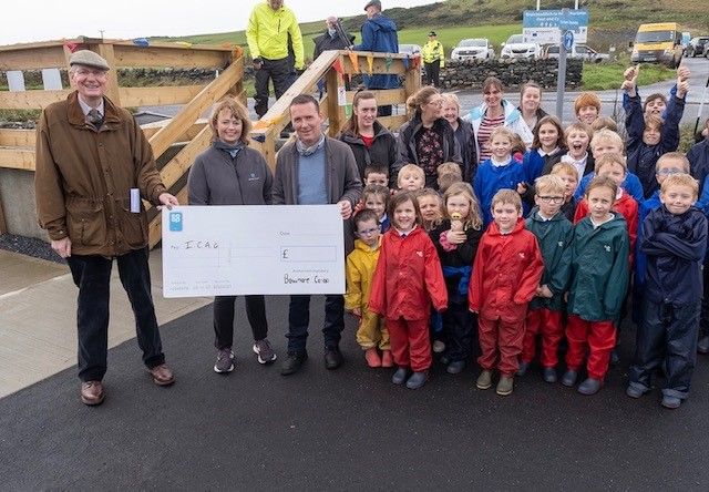
The Loch Indaal Way project was spearheaded by the Islay Community Access Group (ICAG), a local network of volunteers with a vision to increase health and wellbeing through greater outdoor accessibility.

Patrick McGrann, Head of the ICAG, said:

“ICAG, a small voluntary group, worked for 6 years to deliver the Loch Indaal Way. We are extremely proud of our new community asset .To see local folk and visitors of all ages and abilities enjoying access to the countryside is heart warming. We have involved our community throughout and all have ownership and satisfaction of a job well done.”

Pat McGrann, Head, Islay Community Access Group

With the support of Sustrans’ Places for Everyone programme, ICAG secured the a large part of the funding to deliver the 2.53km off-road active travel route.

Sustrans and ICAG previously worked together to deliver the lauded Three Distilleries Path at Port Ellen, a popular 5km active travel route which takes in the Laphroaig, Lagavulin and Ardbeg distilleries.

Emily Gait, Infrastructure Coordinator for Sustrans, said:

“The Loch Indaal Way is a great example of where a community have worked together to create a project which meets the needs of the people who live and visit the area. Inclusive designs and strong community backing have been key to the ultimate success of this project.

Going forward, we hope this inspires other small communities across Scotland to nurture their own walking, wheeling and cycling ambitions.”

Emily Gait, Infrastructure Coordinator, Sustrans

Key features of the route include three upgraded and newly created crossings, as well as landscaping and placemaking initiatives such as the provision of comfortable seating areas and shrubbery sections.

Smooth gradients and minimal placement of steps also maximise accessibility for users with limited mobility.

Change through community

New and upgraded crossings, minimal steps and barriers, as well as added seating areas and landscaping initiatives were fundamental to the designs. Credit: ©2021, Lisa Irvine/Sustrans, all rights reserved.

The proposals to create a new off-road walking, wheeling and cycling route between Port Charlotte and Bruichladdich received popular community support from the outset.

Through an proactive and considered period of engagement, ICAG worked closely with local landowners to secure necessary land donations to make the path a reality.

The local Bruichladdich Distillery also became involved in the promotion and funding behind the project, even entering into a maintenance agreement with ICAG to ensure to path stays fit for purpose.

AJ Cunningham, Operations Manager at Bruichladdich Distillery, said:

“Even before the path was finalised, it was being adopted by a lot of locals. I don’t think this was out of them being inquisitive, either. It’s just a really enjoyable and risk-free way to walk where they didn’t have that option before.

I don’t think it could’ve worked out any better unless you took it all the way out to Bridgend!”.

AJ Cunningham, Operations Manager, Bruichladdich Distillery

Evident local enthusiasm for project only further increased as construction got well underway against the backdrop of the coronavirus pandemic.

A safer, healthier future

An opening event for the Loch Indaal Way took place in October 2021, featuring attendees from Port Charlotte Primary School and the Islay Pipe Band. Credit: ©2021, Islay Community Access Group, all rights reserved.

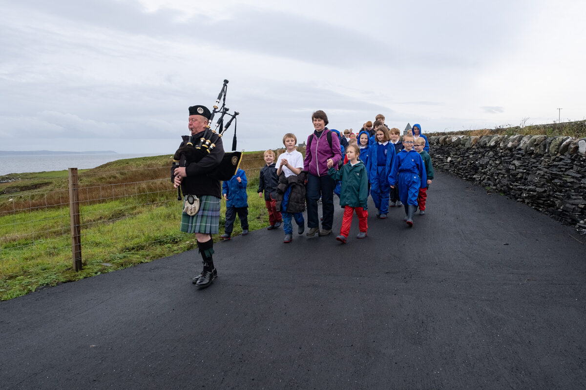
At an opening event in October of last year, children from Port Charlotte Primary School led a procession along the Loch Indaal Way from the Port Ban war memorial to Bruichladdich Town Hall.

They were joined on-route by local residents, members of ICAG and the local Baptist Minister, as well as the musical stylings of the Islay Pipe Band.

After passing several renowned destinations, including the Bruichladdich Distillery, the event culminated in a ceremonial ribbon cutting, which officially opened the route for all users to enjoy.

Children from Port Charlotte Primary School have provided artworks depicting key attractions along the route, including St. Kiaran’s Church and Loch Idaal House lighthouse. Credit: ©2021, Islay Community Access Group, all rights reserved.

Six months on, and The Loch Indaal Way is now an indispensable part of daily life on Islay.

A local group of swimmers use the path for convenient access to the beach as part of weekly meet-ups.

Attendees of St Kiaran’s Church hold fortnightly walks along the path.

A recently installed cycle repair station has also been well received by the community, ensuring daily errands, active commutes and leisure trips are able to continue with minimal disruption.

Categories
Case Studies News News & Opinion Places for Everyone

First phase complete for £10.6m Inverness City Active Travel Network

Extending from Raigmore Interchange to the Golden Bridge, a new walking, wheeling and cycling link funded by Places for Everyone has been officially opened in Inverness.

The Raigmore Active Travel Link, will enable a safe, traffic-free option for those wishing to access Raigmore Estate, Inverness Campus, Inverness Shopping Park.

The accessible route also smartly joins up with other active travel infrastructure in the area to provide connections with Raigmore Hospital, local employers and onwards to retail and residential areas.

Accessibility in design

The Raigmore Active Travel Link is the first major phase of the landmark £10.6m Inverness City Active Travel Network to be completed.

As the first Places for Everyone project to be awarded Category 4 status in the Highlands, this marks a significant moment for the programme.

The wide route delivers a smooth and graded surface for users to make access to key destinations as convenient as possible.

The Raigmore Active Travel Link has been designed to provide a low gradient route, reducing the effects of the steep hill leading up to the Raigmore Community, providing a wide walking, wheeling and cycling ramp with rest areas for all users to enjoy.

The existing stairs which joined Raigmore Community to the interchange have been upgraded to tie into the new design, to ensure quick direct access.

The next phases of this project involve working with Transport Scotland and Sustrans at Raigmore Interchange.

Additionally, work is beginning to look at the potential for active and bus infrastructure linking the Interchange to the city centre along Millburn Road, utilising active travel and Bus Partnership Funding.

Consultation and engagement on these future phases will take place during 2022.

The site was officially opened by Elected Members, Raigmore Community Council, and the Primary 5 pupils from Raigmore Primary School nearby, who are Junior Road Safety Officers (JRSOs) for the school .

These JSROs are an important part of the primary school as they help raise road safety awareness and promote road safety issues to everyone in the school and the wider community, and the pupils have been very eager to learn about the new infrastructure which has been created in their local area.

Pupils from Raigmore Primary School joined Council staff last week to learn about the new link. Video: The Highland Council.

The pupils joined Council staff on site last week to learn about the active travel infrastructure and to be part of some filming on the active travel link. 

Bet McAllister, Depute Provost of Inverness said:

“This is the first large active travel investment in Inverness which Highland Council have delivered in partnership with our project partners and funders Sustrans, through their Places for Everyone fund.  To have a significant, high quality investment enabling safe, direct routes for walking, wheeling and cycling will help to encourage local people to be more active for everyday journeys, while also reducing our impact on climate change.  We celebrate the opening of this link today, but we are looking forward to the significant future investment which is planned as part of the Active Travel Network over the coming years.”

Bet McAllister, Depute Provost of Inverness

The Raigmore Active Travel Link has been funded through Sustrans’ Places for Everyone programme as part of the Inverness City Active Travel Network, a £10.6m active travel project investing in key walking, wheeling and cycling routes throughout the city.

Maelle Ducreux, Infrastructure Coordinator for Sustrans, said:

“The new Raigmore Active Travel Link will have an immediate positive impact on people walking, wheeling, and cycling between the Campus, Raigmore Estate and Inverness City Centre. These benefits will be felt further when improvements planned for Raigmore Interchange and Millburn Corridor are implemented. The development has also provided the opportunity to reinstate native tree species along the embankment which not only make the route more attractive but will provide valuable shielding from the trunk road”.

Maelle Ducreux, Sustrans

The Active Travel Link took 40 weeks to complete, and was constructed by Pat Munro, a local contractor who won the tender for this work. Mark Smith, Contracts Manager at Pat Munro, said:

“The Raigmore Active Travel Link has been a great project to be involved in and we’re delighted it is now open to the public.

The Raigmore community has been very understanding throughout the construction so we’d like to thank them, once again, for their patience. We hope the local community and others travelling by foot, bike or wheel enjoy using the travel link for many years to come.”

Mark Smith, Pat Munro

Munro Ross, Chair of Raigmore Community Council, said:

“This has been an exemplar project in terms of community engagement and professional work taking place in our community. We look forward to engaging with future projects in the local area, the bar has now been set in terms of engagement and expectations.”

Munro Ross, Raigmore Community Council
Categories
Case Studies News News & Opinion Places for Everyone Project/Department Filtering

Transformational active travel project soon to begin in Stirling

From left to right: Clackmannshire Council Leader Cllr Ellen Forson with dog Loki, Stirling Council Leader Cllr Scott Farmer, Stirling Council Depute Leader Cllr Chris Kane, Sustrans Portfolio Director for Scotland Karen McGregor, Environment Advisor at the University of Stirling Amy Gove-Kaney. Photo: Stirling Council/Whyler Photos.

Construction of the Walk, Cycle, Live Stirling project is set to begin in March of this year.

A landmark project for the city, the scheme intends to not only improve safety and accessibility for those travelling by foot and wheel, but also seeks to increase economic activity and footfall for local businesses.

The project received £6.8m in funding from Places for Everyone, as well as £2.5m of Scottish Government investment from the City Region Deal and £258k from Stirling Council’s developer contributions allocation.

The city-wide plan also presents Stirling Council and partners with new place-making and tourism opportunities along the new routes, with the infrastructure also laying the foundations for future connections to Clackmannanshire and the wider Forth Valley region.

A detailed look

The project will deliver two main connections throughout the wider city. Illustration: Stirling Council

6.5km of new infrastructure will be created in total, smoothly interlinking with existing but currently disconnected routes across the city in order to connect communities, businesses and higher education institutes throughout Stirling for active travel for the first time.

Route one will provide a safe and accessible route between Stirling Train station and the University of Stirling, taking in iconic landmarks like Old Stirling Bridge and the National Wallace Monument along the way.

Route two will bridge the gaps between Forth Valley College and the City Centre along Albert Place, Dumbarton Road and Raploch Road, under the shadow of Stirling Castle.

The wider picture

The two new routes will pass iconic sites such as Stirling Castle and Wallace Monument. Photo: Stirling Council/Whyler Photos.

In attendance at a launch event for the project alongside local councillors, residents and business owners, Sustrans’ Portfolio Director Karen McGregor said:

“Walk, Cycle, Live Stirling is a truly transformative project that we at Sustrans are excited to be working on as part of our Places for Everyone programme. The project will make walking, wheeling and cycling safer and more enjoyable for everyone, making it easier for people to move between the iconic landmarks that make Stirling the unique place that it is.”

Karen McGregor, Sustrans

Stirling Council Leader, Cllr Farmer said:

“For the first time ever we’ll be able to create seamless sustainable travel options that link the institutions and businesses of our City with their local communities, setting a new standard of local active travel infrastructure.

This investment will make it easier to walk or wheel around Stirling and we hope this improved and increased access will not only meet the growing demands for better active travel infrastructure, but embed a culture that embraces cycling, walking and wheeling in the everyday lives of the people who live, work and visit Stirling.”

Cllr Farmer, Stirling Council Leader

As one of the cornerstone projects of the £90.2million Stirling and Clackmannanshire City Region Deal, Walk, Cycle, Live Stirling delivers connections which extend far beyond the city itself, whilst also further emboldening the Scottish Government’s plan to tackle climate change.

Clackmannanshire Council Leader, Ellen Forson said:

“I am delighted to see this project start to take shape. It will improve connectivity for our residents by providing a link to routes already established in Clackmannanshire, and is a great example of partnership working through the Stirling & Clackmannanshire City Region Deal.”

Cllr Forson, Clackmannanshire Council Leader

Scottish Government Economy Secretary Kate Forbes said:

“These walking and wheeling corridors will promote more sustainable travel, healthier lifestyles and opportunities for tourism while connecting Stirling’s educational institutions, businesses and communities.

This is helping deliver the bold and ambitious actions we need to help reduce carbon emissions to net zero and encourage sustainable economic growth.”

Kate Forbes, Scottish Government Economy Secretary

Initial construction will start in tandem on Raploch Road East near the King’s Knot, and Airthrey Road near the University.

The project is due to be completed by March 2024, whereupon Walk, Cycle, Live Stirling will serve as a major active travel network for communities across the wider Stirling landscape.

Categories
Case Studies Engage • Inspire • Learn News SfP

20mph roll out in the Scottish Borders

We hear from Philippa Gilhooly, Team Leader, Traffic and Road Safety, Scottish Borders Council and Greg Fountas, Lecturer, School of Engineering & the Built Environment, Edinburgh Napier University, who share how they used data and public feedback to convert this temporary 20mph trial to permanent.

Categories
Case Studies News News & Opinion Places for Everyone Project/Department Filtering

£13.7 million Stockingfield Bridge celebrates first crossing

The first crossing of many. The new bridge provides a key walking, wheeling and cycling link across North Glasgow. Photo: James Chapelard/Scottish Canals

An iconic design and construction

The completed construction of Stockingfield Bridge marks a significant milestone for the £13.7 million Places for Everyone project.

Once complete, the bridge will connect the communities of Maryhill, Gilshochill, and Ruchill in North Glasgow for walking, wheeling and cycling for the first time.

A major boost to health and wellbeing, the new bridge will give local residents stunning views of the city and a convenient access point to the Forth & Clyde Canal in a way not before possible.

The stylish construction of Stockingfield Bridge. Photo: Scottish Canals.

The uniquely forked structure of the bridge not only maximises the number of active travel connections available to users, including improved accessibility to Glasgow west end and city centre, but also serves as a stylish centrepiece to the restored greenspace in the area.

Added public realm improvements, such as seating areas and tree and shrub planting, will help build a sense of community in the area and offer shared space for relaxation and socialisation.

The imminent addition of community artworks along the route will further consolidate the value of the impressive structure.

For those walking, wheeling or cycling further afield, the completion of the bridge also links together the smooth and continuous route stretching the length of the canal from Bowling on the Clyde to Edinburgh in the east via National Cycle Network Route 754.

The inaugural crossing

Left to right: Andrew Thin, Scottish Canals, Catherine Topley is the Chief Executive Officer at Scottish Canals, Patrick Harvie MSP, Karen McGregor, Sustrans, and local resident David Galbraith. Photo: James Chapelard/Scottish Canals

To mark the construction of Stockingfield Bridge, representatives from Scottish Canals, Glasgow City Council and Sustrans joined Minister for Zero Carbon Buildings, Active Travel and Tenants’ Rights, Patrick Harvie MSP as well as local residents to be the first to cross Stockingfield Bridge.

Minister for Active Travel Patrick Harvie said:

“It’s fantastic to see the Stockingfield Bridge take final shape and reconnect communities across the north of Glasgow. The Scottish Government has provided over £13 million to deliver this project because it unlocks real change in the opportunities that people will have to travel more actively – improving health, wellbeing and protecting our environment.

Patrick Harvie, MSP, Scottish Green Party

The project is being delivered by Scottish Canals with funding from the Scottish Government through Sustrans’ Places for Everyone scheme, as well as the Glasgow City Council’s Vacant Derelict Land Fund.

Karen McGregor, Portfolio Director for Sustrans, said:

“The completed construction of Stockingfield Bridge creates invaluable space for walking wheeling and cycling, and represents a significant improvement to the health and wellbeing of the people of North Glasgow.

“Not only does this new connection create a safe and convenient active travel route between Ruchill, Gilshochill, Maryhill and on to the west end and city centre, it opens up a scenic setting for residents and visitors in the area to relax and enjoy what the Forth and Clyde Canal has to offer.”

Karen McGregor, Sustrans

Richard Millar, Chief Operating Officer at Scottish Canals, said:

“Stockingfield Bridge will greatly boost active travel alternatives for people travelling about the city, making a walking or wheeling commute to work a viable and enjoyable experience.

For the first time, locals will be able to move effortlessly from these three communities to the city centre and the west end, providing new access to amenities, services, and employment possibilities. The project’s community-led art element will make Stockingfield a completely new destination, attracting new people to visit and raising the reputation of this section of the city to new heights.”

Richard Millar, Scottish Canals

Community artworks to come

Groundwork and community art installations will continue until September, which will mark the end of the project. Photo: James Chapelard/Scottish Canals

People travelling by foot and wheel will soon be able to enjoy everything the project has to offer.

Final works include groundwork initiatives along the towpath, which incorporates a new recreational space and the delivery of 8 community artwork installations, celebrating the proud industrial history of the area.

All of the artworks have a local link along with community participation. They range from sculptures commemorating the area’s industrial background to ceramic mosaics created by the community and metalwork honouring the role of disabled people in North Glasgow.

The project is due to be completed during the 200th anniversary of the Union and Caledonian canals in September, when the bridge will open to the wider public.

The conclusion of this landmark undertaking will mark a new era for Scotland’s inland waterways, one that prioritises active travel, health, and community.

Categories
Case Studies News News & Opinion

£2.1 million award for Greenock town centre active travel redesign

Plans to open up West Blackhall Street in Greenock for walking, wheeling and cycling have taken a significant step forward with the award of £2.1 million of funding from Sustrans’ Places for Everyone programme.

Alongside £1.9 million from Inverclyde Council and £580,000 from Strathclyde Partnership for Transport (SPT), this latest award brings the total project cost to £4.5 million.

The designs include widened footways and a dedicated cycle lane in an effort to make West Blackhall Street a more accessible and inviting space for people to spend their time.

The rejuvenated street will be of particular benefit to local retail and hospitality businesses due to the focus on increasing foot traffic to the area.

Putting people first

At present, the segmented layout and narrow footways of West Blackhall Street make the route hard to access for many residents and visitors. A lack of a cycling infrastructure further compounds this issue.

The current proposals will transform the street to create a welcoming environment by realigning the carriageway, widening the footways, adding a dedicated cycle lane and reallocating parking.

Designs for West Blackhall Street include widened footways, a dedicated cycle lane and additional placemaking initiatives.

Public realm improvements, including added seating and landscaping initiatives will also contribute towards enhancing the space, and will hopefully encourage those visiting to stay for longer.

A new cycle lane running parallel to the footway has been designed to make local trips easier and safer for residents.

A welcome restoration

On the announcement of further funding for the project, Councillor Michael McCormick, Inverclyde Council’s convener of environment and regeneration, said:

“The redevelopment of West Blackhall Street has been a long time coming but now, with the support of our funding partners and the council’s contribution, we’re able to press ahead with the work and revitalise this important Greenock Town Centre location for locals, visitors and businesses alike.”

Once finished, West Blackhall Street will be vibrant and accessible street to encourage visitors from near and far to discover what Greenock and Inverclyde has to offer.

Michael McCormick, Inverclyde Council

As well as improving the look, feel and experience of the street, the designs of the project aim to reduce emissions in area and improve public health through better air quality.

Emily Gait, Infrastructure Coordinator from Sustrans, said:

“We’re excited to be working with Inverclyde Council and the local community to get this ambitious project underway. By opening up West Blackhall Street for walking, wheeling and cycling, this project puts the health and livelihoods of Greenock residents first, making the streets safer and more enjoyable for everyone.”

Emily Gait, Sustrans

SPT chair of operations, Councillor David Wilson, said:

“Significant funding investment by SPT in recent years has already helped transform parts of the town centre, helping make it a much more welcoming pedestrian, wheeling and cycle friendly environment for local residents, tourists and visitors alike.

These latest plans for West Blackhall Street are another positive step towards improving the town’s streetscape and public realm as well as improving connections with public transport and links for cruise ship visitors to the town centre.”

Cllr David Wilson, SPT

With all the funding necessary now secured, works on the project could begin as soon as summer this year.

Categories
Case Studies News News & Opinion Places for Everyone

Construction begins on major active travel route in Edinburgh

The City Centre West to East Link (CCWEL) will see the east and west of the Capital connected for active travel the first time and will revolutionise the journeys of cyclists and pedestrians for years to come.

Thinking for the future

The CCWEL project will extend from Roseburn to Leith Walk via Haymarket and the West End through the construction of a safe and direct cycle route, as well as significant street enhancements for those walking, wheeling and spending time there.

The main route will consist of two-way segregated cycleways from Roseburn to Haymarket, connecting to one-way segregated cycleways on each side of Melville Street. From Melville Street, two-way cycleways will link George Street with Picardy Place via St David Street, Queen Street and York Place. Public realm improvements, including new pedestrian crossings, enhanced pavements and street trees will also be introduced.

Crucially, CCWEL will also connect with several other transformative projects Sustrans is partnering on with City of Edinburgh Council, including the George Street and First New Town project and the Meadows to George Street scheme.

Cause for celebration

To mark the momentous event, a groundbreaking ceremony took place in Roseburn on Tuesday 8th February.

In attendance, Transport Convener Councillor Lesley Macinnes and Minister for Zero Carbon Buildings, Active Travel and Tenants’ Rights, Patrick Harvie joined Sustrans’ Scotland Portfolio Director, Karen McGregor.

Children from the nearby Roseburn Primary School, local residents in the area and project managers also gathered for the occasion.

We spoke to Patrick Harvie MSP, Cllr Lesley MacInnes, Sustrans’ Karen McGregor and local residents to get their thoughts on the day.

Asked about the project, Minister for Active Travel Patrick Harvie said:

“I’m pleased to see Scottish Government funding enable the construction of the City Centre West to East Link. It’s a vital connection which will help people to walk, wheel and cycle in Edinburgh as the natural choice, leading to better health, less congestion and a better environment.

Patrick Harvie, MSP for Glasgow

Portfolio Director for Sustrans, Karen McGregor said:

“The City Centre West to East Link is a major breakthrough for active travel in Edinburgh. Not only will this deliver safe and accessible walking, wheeling and cycling routes for anyone travelling through the heart of our Scottish capital, it will play an important part in connecting communities in the city’s western and northern suburbs to make their everyday lives healthier and easier”.

Karen McGregor, Sustrans

Like other plans for the city, CCWEL plays a big part in the Council’s City Mobility Plan 2020, which envisions a clean, connected and net zero carbon future by transforming the way people, goods and services travel around the city.

Councillor Lesley MacInnes, Transport and Environment Vice Convener, said:

“The CCWEL project is just one of a range of bold initiatives to transform the way we travel around Edinburgh. We are committed to becoming a net zero city by 2030 and a key element of this is encouraging and supporting clean and sustainable modes of transport through projects like this.”

Councillor Lesley MacInnes, Transport and Environment Convener

Construction on the project is expected to last around 18 months.

Categories
Case Studies News

How a road closure in Glasgow has made locals feel safer and more connected

Kelvin Way has been opened to people on foot, bike and wheels during the pandemic.

In spring 2020, Glasgow City council launched its Spaces for People project in partnership with Sustrans Scotland.

The temporary changes across Glasgow support physical distancing and active travel during the Covid-19 pandemic.

Temporary cycle lanes have been constructed on a number of key routes throughout the city, to provide a safe lane for people cycling.

Pavements have also been widened to allow people space to physically distance in the city centre.

The most ambitious temporary intervention has seen the closure of Kelvin Way, stretching for over 500 meters through the middle of Kelvingrove Park.

Kelvin Way has been closed to traffic since the height of the lockdown. Vehicles can access the Kelvingrove Art Gallery and Museum, but the street remains an open space for walking and cycling, and the benefits it brings are welcomed by the local community.

The case for space on Kelvin Way

With traffic on the roads, residents from densely populated areas nearby struggled to keep a safe distance from other people and moving traffic.

By closing it to traffic, residents are able to physically distance whilst out for a walk, cycle or wheel.

During recurring periods of lockdown, the street provides vital space for people from separate households to meet for exercise and to stay connected.

Children walking, cycling or scooting along the Kelvin Way don’t have to worry about traffic, and have space to connect with others, play and exercise.

Access for Everyone

Kelvin Way is adjacent to the boundary of the Yorkhill and Kelvingrove Cycling Village, a community-led initiative which aims to create ‘the most accessible community in Scotland.’

Creating an active travel link along Kelvin Way is key to making the area accessible for all, not just those with cars.

Kelvin Way connects Yorkhill and Kelvingrove with the University, Hillhead primary School and other amenities. There is also a wide range of independent shops and cafes close to each end of the street.

It is an important active travel link for the residents of Yorkhill and Kelvingrove and the surrounding areas.

Children and parents on the school run don’t have to worry about traffic.

Safety in numbers

Before the closure, Kelvin Way was a busy thoroughfare for traffic to and from the West End. Pedestrians were forced onto uneven and poorly lit pavements, and it did not feel like a secure place to walk in the dark.

Having more people around has made the area feel safer, particularly for women and more vulnerable people.

As the nights draw in, Kelvin Way remains an attractive space for everyone to walk. The centre of the road is well-lit and pedestrians are no longer confined to the shadowy pavement.

Attractive by day and night

Some planters have been added to the street following the initial closure.

Wooden planters have been provided by Glasgow Wood Recycling and there are also distinctive black and white ZICLA planters, to make the area more amenable.

Cllr Anna Richardson, Convener for Sustainability and Carbon Reduction said:

“These revisions proposed for Kelvin Way will provide a more sustainable long-term layout and ensure that those out walking, wheeling and cycling in this popular area continue to have the safer space to do so.

“As the Spaces for People programme develops further, we’ll be seeking to improve the appearance of temporary measures where possible, and I’m really looking forward to seeing the planters installed, further enhancing the popularity of this space.”

More information on City of Glasgow Council’s Spaces for People programme can be found here.

Categories
Case Studies News

The community-led transformation taking place in Dundee city centre

Once lined with parked cars and busy with through traffic, Union Street is now a spacious destination for foot and wheel. Paul Reid/Sustrans

Planning out of a pandemic

Earlier this year, Dundee City Council launched its £2.46 million Spaces for People project in partnership with Sustrans Scotland.

As with all Spaces for People projects, temporary changes in Dundee are aimed at supporting physical distancing and active travel during the Covid-19 pandemic.

So far, sections of The Esplanade and Douglas Terrace have been closed to motor traffic to provide additional space for people to safely walk, wheel and cycle.

20mph speed restrictions have also been introduced in key locations throughout the city.

The most dramatic and celebrated temporary intervention thus far installed, however, is the opening of Union Street to people on foot, bikes and wheels.

The case for Union Street

Union Street is firmly in the heart of Dundee, and is host to an array of independent businesses and traders.

It is also a popular destination for people looking for something to eat or drink.

Union Street in Dundee is home to a range of independent businesses and would usually be bustling with people. Paul Reid/Sustrans

Prior to the current interventions, parked cars either side of heavy two-way traffic made Union Street a treacherous route to cycle, with limited space for people walking or wheeling to get around.

The combination of a predicted return to heavy footfall and existing narrow pavements prioritised Union Street as an essential location for the council’s Spaces for People measures.

An inspired space

Following discussions with local business owners, a comprehensive plan was drawn up to close Union street to non-essential traffic.

This would allow people to walk, wheel and cycle comfortably and safely, whilst still maintaining disabled, loading and emergency vehicle access.

These changes were initially achieved through road signage and temporary cone barriers. These were soon replaced with attractive wooden planters and outdoor seating.

As a final flourish to tie the changes together, an iconic colourful super graphic was installed on the road surface.

Planters, outdoor seating and vibrant creative design has trasnformed Union Street into an iconic destination. Paul Reid/Sustrans

Inspired by the layout and function of a pedestrian crossing, the primary intention of the new creative design is to raise driver awareness to the new priorities of the street.

Graphic Design graduate Callum Laird created the original designs for street graphic.

This was then translated into the real world by Scenic Deisgner Leila Kalbassi, with painting assistance provided by a team of recent graduates and volunteer residents.

Union Street prior to temporary Spaces for People changes (left) and after (right). Paul Reid/Sustrans

The new layout has proved broadly popular with residents, visitors and local businesses, so much so that the lifetime of the temporary changes has now been extended beyond the initial proposed end date of October.

Union Street will remain a walking, wheeling and cycling only zone through early 2021, with an option to further extend the changes.

Community co-design

Ensuring that local business owners were involved in the decision making process was a crucial part of making Union Street a success.

Due to Covid-19 restrictions, online workshops were delivered through Dundee’s Service Design Academy.

This allowed key concerns such as maintaining access rights for traders and suppliers to be accounted for and factored in to the final designs.

By taking a co-design approach, the engagement undertaken was more than a consultation, and traders and residents were able to directly influence the outcome on the street.

The provision of outdoor seating areas to restaurants, bars and cafés, has been particularly beneficial in encouraging people to support local businesses whilst still maintaining a safe physically distance.

Businesses have been supported by being involved in the design process, with access rights for loading maintained and outdoor seating provided. Paul Reid/Sustrans

Beautification of the area through the installation of floral planters and street art only further creates a sense of place to attract locals and visitors to the area.

More information on Dundee City Council’s Spaces for People programme can be found here.

Categories
Case Studies News

Public health improvements for Glasgow transport hubs

As the most heavily populated city in Scotland, Glasgow is home to an extensive network of bus and rail links. John Linton/Sustrans

Creating a safe commute

As we hit six months since the beginning of the Covid-19 pandemic, the public transport sector is still facing significantly reduced demand across all services.

Compared with this time last year, bus and rail journeys in Scotland are down 50% and 70%, respectively.

At the height of the Covid-19 pandemic in Scotland, traffic one once busy streets almost completely evaporated overnight. John Linton/Sustrans

However, with more people now returning to their physical workplaces, and with the return to schools and universities, a considerable uptake in daily public transport use is expected over the coming months.

If not managed correctly, we could see delays in journey times for passengers, and increased demand could make physically distancing near impossible.

In order to address this concern, Sustrans is working with Scottish local authorities through its Spaces for People programme to ensure that people are able to access and use the transport services they need safely.

Key case study

Central Station and Queen Street Station are the two major train stations in the heart of Glasgow city centre.

The routes covered not only facilitate travel to and from work, but also provide access to local and regional healthcare providers, grocery stores, leisure facilities and green spaces.

Over the last few months, both sites have undergone significant temporary infrastructure changes thanks to Glasgow City Council‘s £7.5 million Spaces for People project.

Queen Street station

George Street, North Hanover Street and Dundas Street provide the key access points to the newly renovated Queen Street Station.

Extensive changes to George Square have been designed to maximise physcial distancing space for people walking, wheeling and cycling, particularly around Queen Street station. JohnLinton/Sustrans

Widened footways and temporary cycle lanes installed throughout George Square and the surrounding streets ensure that those arriving by foot and wheel are able to safely and easily access any one of Queen Street station’s three entrance points.

The hope is that this will not only give people the space needed to physically distance, but will also increase the uptake of active travel in the city centre, resulting in fewer cars on the road.

Should this be effective, this will leave roads less congested for those that most need them, such as buses, taxis and emergency vehicles.

Automated crossings allow pedestrian signals to turn green automatically without any sarface contact needed. John Linton/Sustrans

Automated crossings have also been introduced in the area in order to minimise the risk of spreading Covid-19 through shared surface contact points.

Central station

Each of Glasgow Central station’s four main access points now benefit from temporary changes designed to both satisfy the needs of passengers whilst making the most of the existing infrastructure.

By introducing a one-way traffic flow on Argyle Street to vehicles heading Westbound, temporary cycle lanes and widened footways could be installed along the route.

Widened footways and temporary cycle lane have made it much easier to access Central station by foot and wheel on Argyle Street whilst maintaining physical distancing. John Linton/Sustrans

Not only has this reduced traffic congestion, but people now have ample space to safely distance from one another as they enter and leave the station, as well as increased opportunities to travel actively for those journeying by bike.

Temporarily reduced access and parking restrictions at Gordon street ensure that maximum distancing space is available to people. A pop-up cycle lane has also been installed to make active travel an easier option.

Limited vehicle access, restricted parking and the addition of a temporary cycle lane on Gordon Street allows easier access to Central Station for cyclists and supports overall physical distancing surrounding the station. Sustrans/John Linton

Lastly, the installation of filtering bollards at the Union Street and Hope Street entrances help ensure that those entering and exiting the station are able to do so as smoothly as possible, whilst also minimising the physical contact time between the different streams of passengers.

Filtered bollards outside of Central station on Hope Street minimise physical contact between streams of opposing foot traffic. Sustrans/John Linton

All of these changes may prove vital in the rush of weekday commuting hours.

‘New normal’ service

Public transport is a vital link to many in accessing work, shops and services. And ensuring they can use this safely is essential to help slow the spread of Covid-19.

For people without access to a car – or for those whose journeys cannot be completed by walking, wheeling or cycling – reliable bus, train and ferry services are a necessity.

If public confidence in transport providers to protect our health is not improved we could see an increase in the use of private cars for short journeys.

It could also have big impacts on our long-term ambitions of securing a greener future for Scotland.

Changes such as those implemented through Spaces for People will take steps to make public transport safer and keep our roads clear for those who need it most.