Categories
Case Studies News News & Opinion Places for Everyone

First phase complete for £10.6m Inverness City Active Travel Network

Extending from Raigmore Interchange to the Golden Bridge, a new walking, wheeling and cycling link funded by Places for Everyone has been officially opened in Inverness.

The Raigmore Active Travel Link, will enable a safe, traffic-free option for those wishing to access Raigmore Estate, Inverness Campus, Inverness Shopping Park.

The accessible route also smartly joins up with other active travel infrastructure in the area to provide connections with Raigmore Hospital, local employers and onwards to retail and residential areas.

Accessibility in design

The Raigmore Active Travel Link is the first major phase of the landmark £10.6m Inverness City Active Travel Network to be completed.

As the first Places for Everyone project to be awarded Category 4 status in the Highlands, this marks a significant moment for the programme.

The wide route delivers a smooth and graded surface for users to make access to key destinations as convenient as possible.

The Raigmore Active Travel Link has been designed to provide a low gradient route, reducing the effects of the steep hill leading up to the Raigmore Community, providing a wide walking, wheeling and cycling ramp with rest areas for all users to enjoy.

The existing stairs which joined Raigmore Community to the interchange have been upgraded to tie into the new design, to ensure quick direct access.

The next phases of this project involve working with Transport Scotland and Sustrans at Raigmore Interchange.

Additionally, work is beginning to look at the potential for active and bus infrastructure linking the Interchange to the city centre along Millburn Road, utilising active travel and Bus Partnership Funding.

Consultation and engagement on these future phases will take place during 2022.

The site was officially opened by Elected Members, Raigmore Community Council, and the Primary 5 pupils from Raigmore Primary School nearby, who are Junior Road Safety Officers (JRSOs) for the school .

These JSROs are an important part of the primary school as they help raise road safety awareness and promote road safety issues to everyone in the school and the wider community, and the pupils have been very eager to learn about the new infrastructure which has been created in their local area.

Pupils from Raigmore Primary School joined Council staff last week to learn about the new link. Video: The Highland Council.

The pupils joined Council staff on site last week to learn about the active travel infrastructure and to be part of some filming on the active travel link. 

Bet McAllister, Depute Provost of Inverness said:

“This is the first large active travel investment in Inverness which Highland Council have delivered in partnership with our project partners and funders Sustrans, through their Places for Everyone fund.  To have a significant, high quality investment enabling safe, direct routes for walking, wheeling and cycling will help to encourage local people to be more active for everyday journeys, while also reducing our impact on climate change.  We celebrate the opening of this link today, but we are looking forward to the significant future investment which is planned as part of the Active Travel Network over the coming years.”

Bet McAllister, Depute Provost of Inverness

The Raigmore Active Travel Link has been funded through Sustrans’ Places for Everyone programme as part of the Inverness City Active Travel Network, a £10.6m active travel project investing in key walking, wheeling and cycling routes throughout the city.

Maelle Ducreux, Infrastructure Coordinator for Sustrans, said:

“The new Raigmore Active Travel Link will have an immediate positive impact on people walking, wheeling, and cycling between the Campus, Raigmore Estate and Inverness City Centre. These benefits will be felt further when improvements planned for Raigmore Interchange and Millburn Corridor are implemented. The development has also provided the opportunity to reinstate native tree species along the embankment which not only make the route more attractive but will provide valuable shielding from the trunk road”.

Maelle Ducreux, Sustrans

The Active Travel Link took 40 weeks to complete, and was constructed by Pat Munro, a local contractor who won the tender for this work. Mark Smith, Contracts Manager at Pat Munro, said:

“The Raigmore Active Travel Link has been a great project to be involved in and we’re delighted it is now open to the public.

The Raigmore community has been very understanding throughout the construction so we’d like to thank them, once again, for their patience. We hope the local community and others travelling by foot, bike or wheel enjoy using the travel link for many years to come.”

Mark Smith, Pat Munro

Munro Ross, Chair of Raigmore Community Council, said:

“This has been an exemplar project in terms of community engagement and professional work taking place in our community. We look forward to engaging with future projects in the local area, the bar has now been set in terms of engagement and expectations.”

Munro Ross, Raigmore Community Council
Categories
Case Studies News News & Opinion Places for Everyone Project/Department Filtering

Transformational active travel project soon to begin in Stirling

From left to right: Clackmannshire Council Leader Cllr Ellen Forson with dog Loki, Stirling Council Leader Cllr Scott Farmer, Stirling Council Depute Leader Cllr Chris Kane, Sustrans Portfolio Director for Scotland Karen McGregor, Environment Advisor at the University of Stirling Amy Gove-Kaney. Photo: Stirling Council/Whyler Photos.

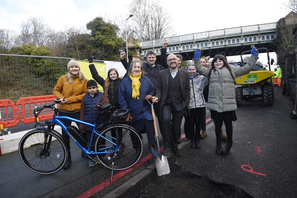
Construction of the Walk, Cycle, Live Stirling project is set to begin in March of this year.

A landmark project for the city, the scheme intends to not only improve safety and accessibility for those travelling by foot and wheel, but also seeks to increase economic activity and footfall for local businesses.

The project received £6.8m in funding from Places for Everyone, as well as £2.5m of Scottish Government investment from the City Region Deal and £258k from Stirling Council’s developer contributions allocation.

The city-wide plan also presents Stirling Council and partners with new place-making and tourism opportunities along the new routes, with the infrastructure also laying the foundations for future connections to Clackmannanshire and the wider Forth Valley region.

A detailed look

The project will deliver two main connections throughout the wider city. Illustration: Stirling Council

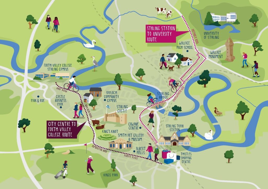
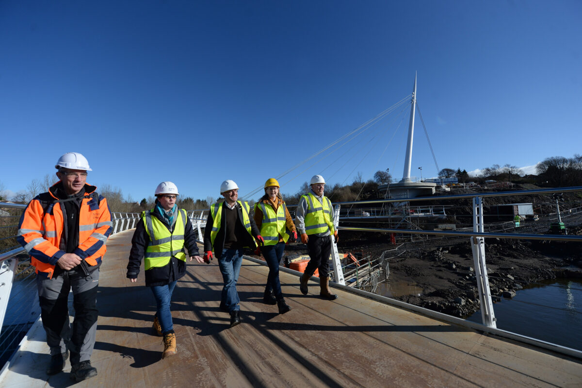
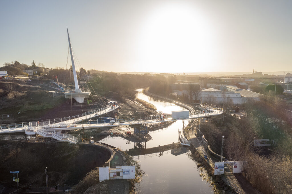
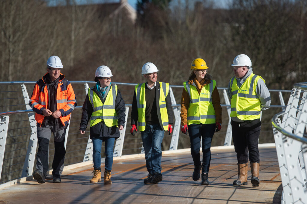
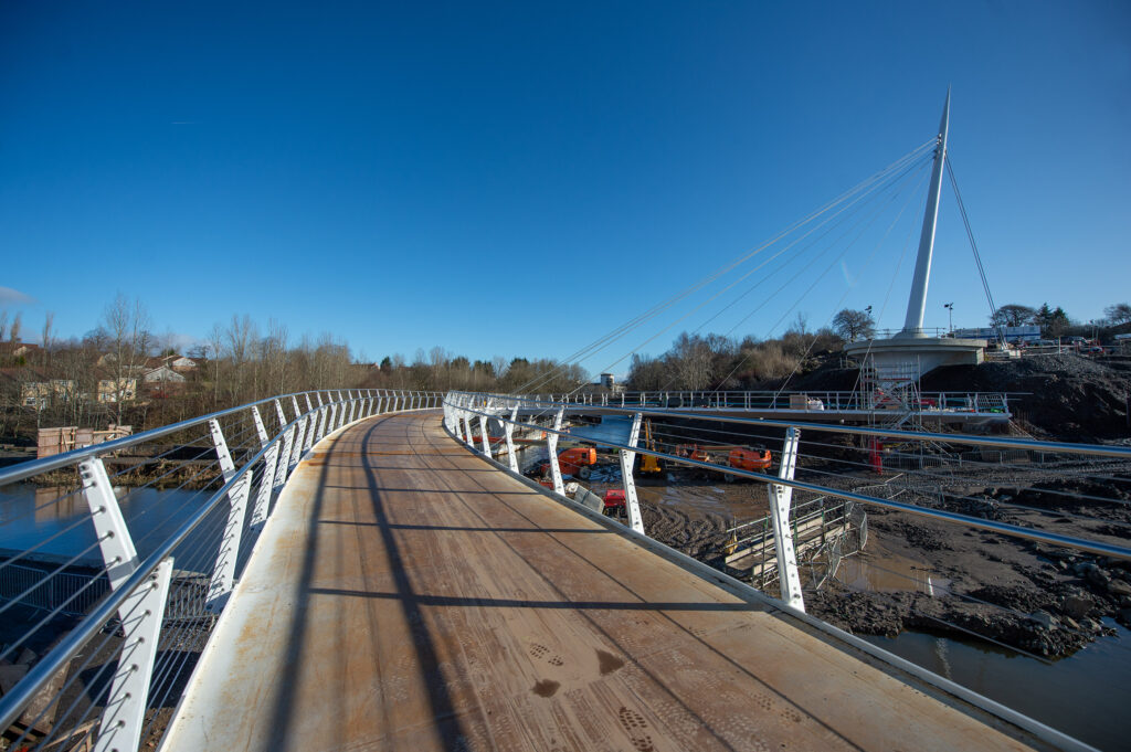
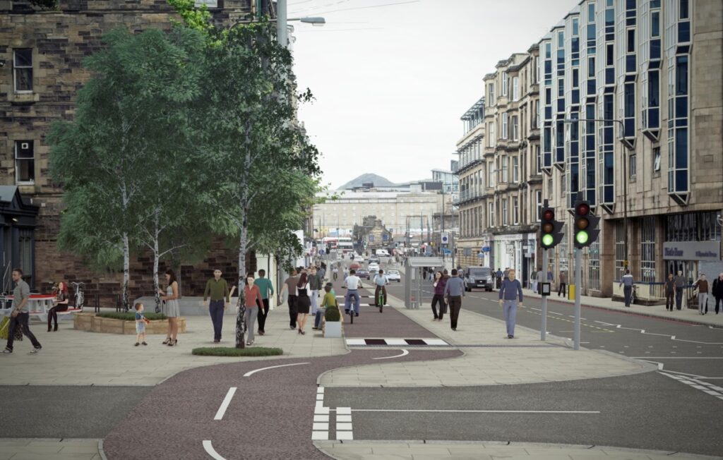
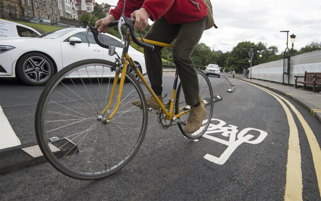
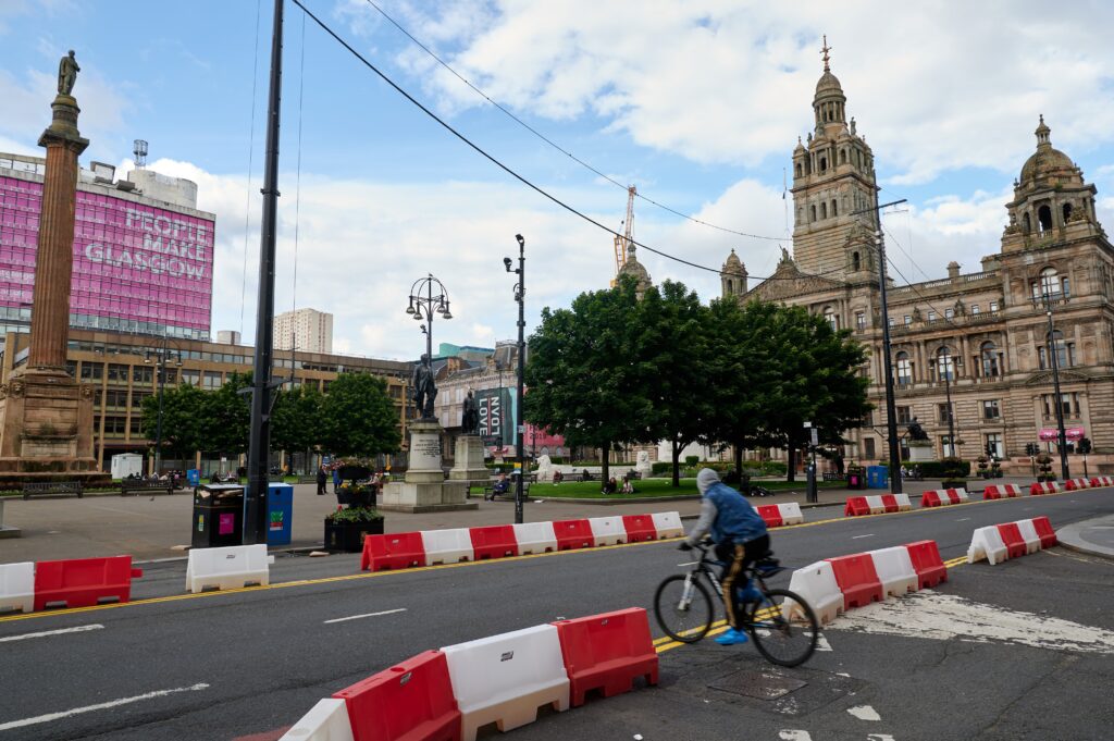
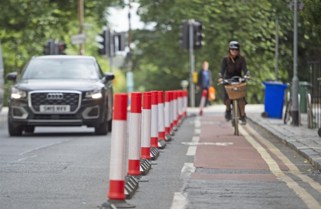
6.5km of new infrastructure will be created in total, smoothly interlinking with existing but currently disconnected routes across the city in order to connect communities, businesses and higher education institutes throughout Stirling for active travel for the first time.

Route one will provide a safe and accessible route between Stirling Train station and the University of Stirling, taking in iconic landmarks like Old Stirling Bridge and the National Wallace Monument along the way.

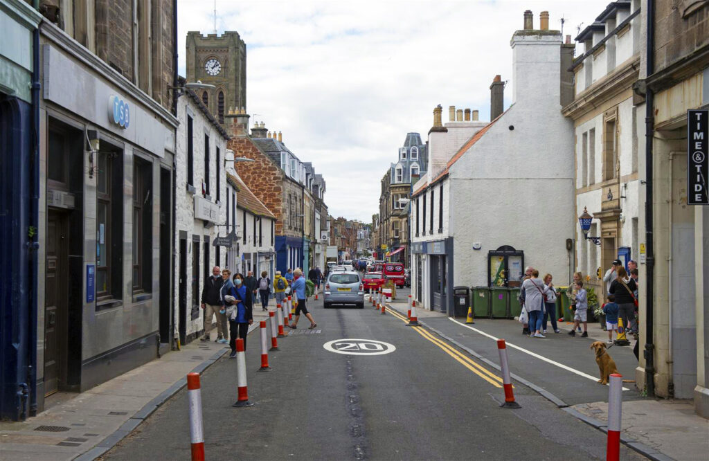
Route two will bridge the gaps between Forth Valley College and the City Centre along Albert Place, Dumbarton Road and Raploch Road, under the shadow of Stirling Castle.

The wider picture

The two new routes will pass iconic sites such as Stirling Castle and Wallace Monument. Photo: Stirling Council/Whyler Photos.

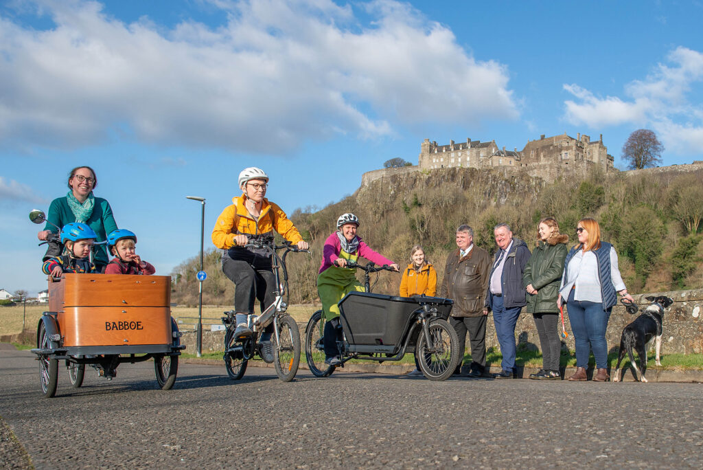
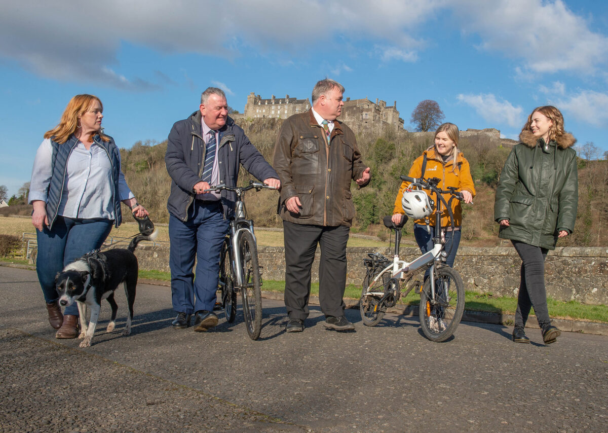
In attendance at a launch event for the project alongside local councillors, residents and business owners, Sustrans’ Portfolio Director Karen McGregor said:

“Walk, Cycle, Live Stirling is a truly transformative project that we at Sustrans are excited to be working on as part of our Places for Everyone programme. The project will make walking, wheeling and cycling safer and more enjoyable for everyone, making it easier for people to move between the iconic landmarks that make Stirling the unique place that it is.”

Karen McGregor, Sustrans

Stirling Council Leader, Cllr Farmer said:

“For the first time ever we’ll be able to create seamless sustainable travel options that link the institutions and businesses of our City with their local communities, setting a new standard of local active travel infrastructure.

This investment will make it easier to walk or wheel around Stirling and we hope this improved and increased access will not only meet the growing demands for better active travel infrastructure, but embed a culture that embraces cycling, walking and wheeling in the everyday lives of the people who live, work and visit Stirling.”

Cllr Farmer, Stirling Council Leader

As one of the cornerstone projects of the £90.2million Stirling and Clackmannanshire City Region Deal, Walk, Cycle, Live Stirling delivers connections which extend far beyond the city itself, whilst also further emboldening the Scottish Government’s plan to tackle climate change.

Clackmannanshire Council Leader, Ellen Forson said:

“I am delighted to see this project start to take shape. It will improve connectivity for our residents by providing a link to routes already established in Clackmannanshire, and is a great example of partnership working through the Stirling & Clackmannanshire City Region Deal.”

Cllr Forson, Clackmannanshire Council Leader

Scottish Government Economy Secretary Kate Forbes said:

“These walking and wheeling corridors will promote more sustainable travel, healthier lifestyles and opportunities for tourism while connecting Stirling’s educational institutions, businesses and communities.

This is helping deliver the bold and ambitious actions we need to help reduce carbon emissions to net zero and encourage sustainable economic growth.”

Kate Forbes, Scottish Government Economy Secretary

Initial construction will start in tandem on Raploch Road East near the King’s Knot, and Airthrey Road near the University.

The project is due to be completed by March 2024, whereupon Walk, Cycle, Live Stirling will serve as a major active travel network for communities across the wider Stirling landscape.

Categories
Case Studies News News & Opinion Places for Everyone Project/Department Filtering

£13.7 million Stockingfield Bridge celebrates first crossing

The first crossing of many. The new bridge provides a key walking, wheeling and cycling link across North Glasgow. Photo: James Chapelard/Scottish Canals

An iconic design and construction

The completed construction of Stockingfield Bridge marks a significant milestone for the £13.7 million Places for Everyone project.

Once complete, the bridge will connect the communities of Maryhill, Gilshochill, and Ruchill in North Glasgow for walking, wheeling and cycling for the first time.

A major boost to health and wellbeing, the new bridge will give local residents stunning views of the city and a convenient access point to the Forth & Clyde Canal in a way not before possible.

The stylish construction of Stockingfield Bridge. Photo: Scottish Canals.

The uniquely forked structure of the bridge not only maximises the number of active travel connections available to users, including improved accessibility to Glasgow west end and city centre, but also serves as a stylish centrepiece to the restored greenspace in the area.

Added public realm improvements, such as seating areas and tree and shrub planting, will help build a sense of community in the area and offer shared space for relaxation and socialisation.

The imminent addition of community artworks along the route will further consolidate the value of the impressive structure.

For those walking, wheeling or cycling further afield, the completion of the bridge also links together the smooth and continuous route stretching the length of the canal from Bowling on the Clyde to Edinburgh in the east via National Cycle Network Route 754.

The inaugural crossing

Left to right: Andrew Thin, Scottish Canals, Catherine Topley is the Chief Executive Officer at Scottish Canals, Patrick Harvie MSP, Karen McGregor, Sustrans, and local resident David Galbraith. Photo: James Chapelard/Scottish Canals

To mark the construction of Stockingfield Bridge, representatives from Scottish Canals, Glasgow City Council and Sustrans joined Minister for Zero Carbon Buildings, Active Travel and Tenants’ Rights, Patrick Harvie MSP as well as local residents to be the first to cross Stockingfield Bridge.

Minister for Active Travel Patrick Harvie said:

“It’s fantastic to see the Stockingfield Bridge take final shape and reconnect communities across the north of Glasgow. The Scottish Government has provided over £13 million to deliver this project because it unlocks real change in the opportunities that people will have to travel more actively – improving health, wellbeing and protecting our environment.

Patrick Harvie, MSP, Scottish Green Party

The project is being delivered by Scottish Canals with funding from the Scottish Government through Sustrans’ Places for Everyone scheme, as well as the Glasgow City Council’s Vacant Derelict Land Fund.

Karen McGregor, Portfolio Director for Sustrans, said:

“The completed construction of Stockingfield Bridge creates invaluable space for walking wheeling and cycling, and represents a significant improvement to the health and wellbeing of the people of North Glasgow.

“Not only does this new connection create a safe and convenient active travel route between Ruchill, Gilshochill, Maryhill and on to the west end and city centre, it opens up a scenic setting for residents and visitors in the area to relax and enjoy what the Forth and Clyde Canal has to offer.”

Karen McGregor, Sustrans

Richard Millar, Chief Operating Officer at Scottish Canals, said:

“Stockingfield Bridge will greatly boost active travel alternatives for people travelling about the city, making a walking or wheeling commute to work a viable and enjoyable experience.

For the first time, locals will be able to move effortlessly from these three communities to the city centre and the west end, providing new access to amenities, services, and employment possibilities. The project’s community-led art element will make Stockingfield a completely new destination, attracting new people to visit and raising the reputation of this section of the city to new heights.”

Richard Millar, Scottish Canals

Community artworks to come

Groundwork and community art installations will continue until September, which will mark the end of the project. Photo: James Chapelard/Scottish Canals

People travelling by foot and wheel will soon be able to enjoy everything the project has to offer.

Final works include groundwork initiatives along the towpath, which incorporates a new recreational space and the delivery of 8 community artwork installations, celebrating the proud industrial history of the area.

All of the artworks have a local link along with community participation. They range from sculptures commemorating the area’s industrial background to ceramic mosaics created by the community and metalwork honouring the role of disabled people in North Glasgow.

The project is due to be completed during the 200th anniversary of the Union and Caledonian canals in September, when the bridge will open to the wider public.

The conclusion of this landmark undertaking will mark a new era for Scotland’s inland waterways, one that prioritises active travel, health, and community.

Categories
Case Studies News News & Opinion Places for Everyone

Construction begins on major active travel route in Edinburgh

The City Centre West to East Link (CCWEL) will see the east and west of the Capital connected for active travel the first time and will revolutionise the journeys of cyclists and pedestrians for years to come.

Thinking for the future

The CCWEL project will extend from Roseburn to Leith Walk via Haymarket and the West End through the construction of a safe and direct cycle route, as well as significant street enhancements for those walking, wheeling and spending time there.

The main route will consist of two-way segregated cycleways from Roseburn to Haymarket, connecting to one-way segregated cycleways on each side of Melville Street. From Melville Street, two-way cycleways will link George Street with Picardy Place via St David Street, Queen Street and York Place. Public realm improvements, including new pedestrian crossings, enhanced pavements and street trees will also be introduced.

Crucially, CCWEL will also connect with several other transformative projects Sustrans is partnering on with City of Edinburgh Council, including the George Street and First New Town project and the Meadows to George Street scheme.

Cause for celebration

To mark the momentous event, a groundbreaking ceremony took place in Roseburn on Tuesday 8th February.

In attendance, Transport Convener Councillor Lesley Macinnes and Minister for Zero Carbon Buildings, Active Travel and Tenants’ Rights, Patrick Harvie joined Sustrans’ Scotland Portfolio Director, Karen McGregor.

Children from the nearby Roseburn Primary School, local residents in the area and project managers also gathered for the occasion.

We spoke to Patrick Harvie MSP, Cllr Lesley MacInnes, Sustrans’ Karen McGregor and local residents to get their thoughts on the day.

Asked about the project, Minister for Active Travel Patrick Harvie said:

“I’m pleased to see Scottish Government funding enable the construction of the City Centre West to East Link. It’s a vital connection which will help people to walk, wheel and cycle in Edinburgh as the natural choice, leading to better health, less congestion and a better environment.

Patrick Harvie, MSP for Glasgow

Portfolio Director for Sustrans, Karen McGregor said:

“The City Centre West to East Link is a major breakthrough for active travel in Edinburgh. Not only will this deliver safe and accessible walking, wheeling and cycling routes for anyone travelling through the heart of our Scottish capital, it will play an important part in connecting communities in the city’s western and northern suburbs to make their everyday lives healthier and easier”.

Karen McGregor, Sustrans

Like other plans for the city, CCWEL plays a big part in the Council’s City Mobility Plan 2020, which envisions a clean, connected and net zero carbon future by transforming the way people, goods and services travel around the city.

Councillor Lesley MacInnes, Transport and Environment Vice Convener, said:

“The CCWEL project is just one of a range of bold initiatives to transform the way we travel around Edinburgh. We are committed to becoming a net zero city by 2030 and a key element of this is encouraging and supporting clean and sustainable modes of transport through projects like this.”

Councillor Lesley MacInnes, Transport and Environment Convener

Construction on the project is expected to last around 18 months.

Categories
Engage • Inspire • Learn

Effective behaviour change

Partners from local authorities and organisations around Scotland were invited to hear from a variety of guest speakers who shared their experience and expertise in influencing attitudes, habits and behaviour.

These sessions are part of the Places for Everyone event programme – Engage · Inspire · Learn

Why it’s important to influence public behaviour

First, we hear from Susanne Mueller, Communities Coordinator, Sustrans Scotland. Susanne highlights two key reasons why it’s important to influence public behaviour, in relation to Active Travel:

  1. Tackling the climate crisis
  2. Improving public health

Leven’s Behaviour Change Action Plan

Next, Susanne is joined by Daniel Prince, Infrastructure Coordinator, Sustrans Scotland and Enid Trevett, Community Engagement Officer, Coalfield Regeneration Trust. They share how the Coalfield Regeneration Trust has successfully co-developed Leven’s Behaviour Change Action Plan. This includes embedding the following values into the Behaviour Change Action Plan:

  1. Local first;
  2. Involve young people;
  3. Using what is already available; and
  4. The spirit of community needs to be fostered through the way actions are delivered.

Cycling Scotland’s Behaviour Change Initiatives

Last, we hear from Katharine Brough, Head of Behaviour Change at Cycling Scotland. Katharine speaks about the Cycling Friendly programme and how the award and grant funding programme works with organisations in a variety of workplace, education and community settings across Scotland. The programme aims to address barriers to cycling and increase access to bikes and cycling rates. The session also touches on the available tools for creating and sustaining behaviour change.

Categories
Engage • Inspire • Learn PfE

Completion of Phase 1 of Connecting Woodside

Connecting Woodside, previously known as Woodside Mini-Holland, was funded by Sustrans Scotland through Places for Everyone, and Glasgow City Council. The Places for Everyone programme is funded by Transport Scotland.
Categories
News News & Opinion

Places for Everyone match funding changes support active travel projects in Scotland

What do you need to know?

Following Transport Scotland’s announcement, Places for Everyone is pleased to be able to confirm a significant change in the match funding requirements for projects.

All projects are now eligible to receive up to 70% funding towards construction costs.

In addition, the 10% cap on pre-construction funding will now only be applied once projects reach construction, i.e. pre-construction funding will be extended 100% and any over payment will be deducted from the grant made available for construction (this will be subject to the Places for Everyone teams discretion).

The Spaces for People programme provided Scottish local authorities £38.97 million to create temporary infrastructure for walking, whee;ling and cycling as part of the Covid-19 recovery. John Linton/Sustrans

What do I need to do now?

  • Category 1-3 projects already at construction stage: Please submit a project update form on the application portal detailing any increased funding request. Where these increases are solely attributable to the increase in intervention rate they will be automatically approved. Should you be requesting increases in funding for any other reason, please include a change control with the form.
  • Category 1-3 projects at design stage: Pleaseincrease your forecast construction request the next time you provide Places for Everyone with an updated programme and spend profile; this will likely be at the next stage review for your project.
  • Category 4 projects not yet approved by Panel: Please follow the previous recommendation for category 1-3 projects. Those partners who are about to submit to Panel should ensure that their submission documents reflect any increase in grant request.
  • Category 4 projects Approved by Panel and other legacy projects in receipt of multi-year funding: Where there is an existing budget or programme revision awaiting approval, please submit revised financial information to the portal via a project update form and both these figures and any previous figures provided will be presented to a Change Control Board alongside your existing change control. If you are not otherwise waiting for approval, please submit a revised grant request via an update form and this increase will be approved.
Categories
News News & Opinion Places for Everyone

How can mapping pavements help support physical distancing?

Mapping pavement widths can help local authorities identify pinch points in urban centres or where physical distancing is otherwise unachievable. High Street, North Berwick. Neil Hanna/Sustrans

Responding to a crisis

With the advent of the Covid-19 pandemic, the scarce amount of space allotted to people across Scotland’s towns and cities is firmly in the forefront.

Attempting to maintain a two-metre physical distance from other pavement users whilst navigating by foot or wheel can be a nuisance at the best of times and an impossibility at others.

In aid of this, Sustrans’ Spaces for People programme, funded by the Scottish Government, has distributed almost £40 million to local authorities to provide temporary infrastructure to help people walk, wheel and cycle.

Spaces for People is delivering temporary infrastructure throughout Scotland to help people walk, wheel and cycle safely through the Covid-19 pandemic. Forrest Road, Edinburgh. Sustrans/Neil Hanna

With a common bid by local authorities’ being to widen public footways, Sustrans have set to calculate and map pavement widths in towns and cities through Scotland to help identify potential crowding pinch points and support physical distancing.

Early mapping in Edinburgh

In 2010, City of Edinburgh Council began work on developing an Active Travel Action Plan, a long-term city-wide project to improve the accessibility and safety of walking, cycling and wheeling infrastructure.

One of the ways Sustrans has been assisting the council with this ambitious project is by undertaking the painstaking work of mapping individual pavement widths throughout the city.

With physical distancing guidelines now in effect as a matter of public health, the construction of a working pavement width database for the whole of Scotland has taken on a new urgency.

Once lockdown was announced, Sustrans accelerated work on providing City of Edinburgh Council with a comprehensive dataset of pavement widths.

This was achieved by adapting code developed for New York to complement Ordinance Survey data.

From this initial success, Sustrans has been able to develop further datasets for Glasgow, East Lothian, Dundee, East Ayrshire and South Ayrshire, with the offer being extended to any other local authorities who would find such data useful.

The coding process

Infrastructure Coordinator for Sustrans Alasdair Anderson was a key player in developing the mapping datasets. As lead on the project, he explains:

“The Python code used to do the analysis utilised Ordinance Survey’s most detailed Mastermap Topograpic Area mapping.

This identifies pavements and paths within a given local authority and accomplishes the surprisingly difficult task of measuring the width of an irregularly shaped object by using a tailored algorithm.

By first calculating the centreline for each of the thousands of bits of pavement that have already been identified, the algorithm then measures the distance back from individual pavement centre point to the pavement edge to calculate the width.

Finally, the results are compiled into a GIS dataset which can be analysed statistically or displayed on a map”.

Alasdair Anderson, Infrastructure Coordinator, Sustrans
Even Edinburgh’s busiest shopping streets have very narrow pavements. Raeburn Place, Stockbridge. Ordinance Survey.

Using the data

An immediate benefit of this data is that it can be used to help people navigate routes which only follow wider pavements.

For example, Sustrans officers have been looking to use pavement widths data to enable them to plan led walks with volunteers or school children once lockdown restrictions are sufficiently eased.

The larger impact, however, of these mapping capabilities is apparent when the data is combined with other information in order to identify the narrowest or busiest streets in order to prioritise them for widening interventions.

While the £38.97 million available under the Spaces for People fund is a lot of money, it is not nearly enough to widen every pavement in Scotland. As such, working out how to prioritise pavement widening initiatives becomes crucial.

Pavement distancing descriptionWidthkm%
Easy>4.7m133.974
Comfortable3.8 to 4.7m105.933.1
Possible2.7 to 3.8m362.7510.7
Difficult2 to 2.7m608.8418
Too narrow1.5 to 2m975.0128.9
Less than minimum design guidance<1.5m1192.835.3
Total ‘difficult’ or narrower<2.7m2776.6582.2
Table demonstrating the widths of pavements throughout Edinburgh as they relate to physical distancing health guidelines.

Applications in Dundee

One of the first practical applications of Sustrans’ pavement mapping capabilities took place in Dundee city centre.

While nearly empty during lockdown, Union Street in Dundee has been closed to traffic in anticipation of crowds of people returning as businesses reopen. Union Street, Dundee. Paul Reid/Sustrans

A dataset of shops and services in Dundee was first created. This was then overlaid with the footway width dataset Sustrans had created to help identify narrow pavements where high footfall was likely to occur. From this, a unique set of Covid-19 emergency proposals for shopping streets in Dundee was able to be generated.

Using these emergency proposals, Sustrans was then able to highlight particular areas where it would be most crucial to prioritise pavement widening interventions.

Areas in blue are streets which would most benefit from widened pavements. Similar approaches have now been utilised in Edinburgh and East Ayrshire.

Looking forward

Looking beyond the Covid-19 pandemic, the datasets Sustrans has created provide local authorities with an invaluable resource with which to maximise the benefit of footway renewal programmes.

Initial progress can be made by first focussing on pavements which fall short of 1.5m, normally considered to be the minimum.

Interventions in areas such as these would improve accessibility for those with additional mobility support needs immensely, such as those manoeuvring a wheelchair or a pram.

Recent adaptations in the code used to calculate pavement widths have now enabled Sustrans to calculate the widths of entire streets.

This new capability could be instrumental in helping Scottish local authorities understand where it would be most beneficial to deliver cycling infrastructure in the future.

Gallery

Take a look at some of the Scottish towns and cities Sustrans has created GIS pavement width maps for in the image gallery below.